
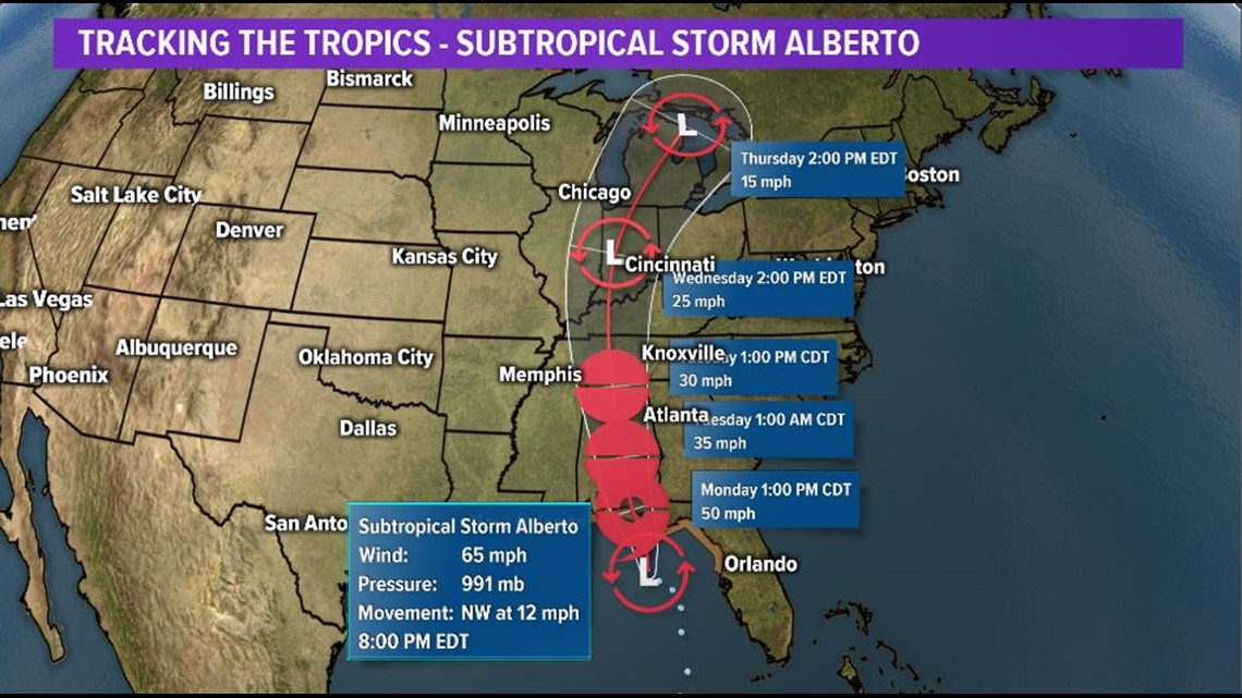
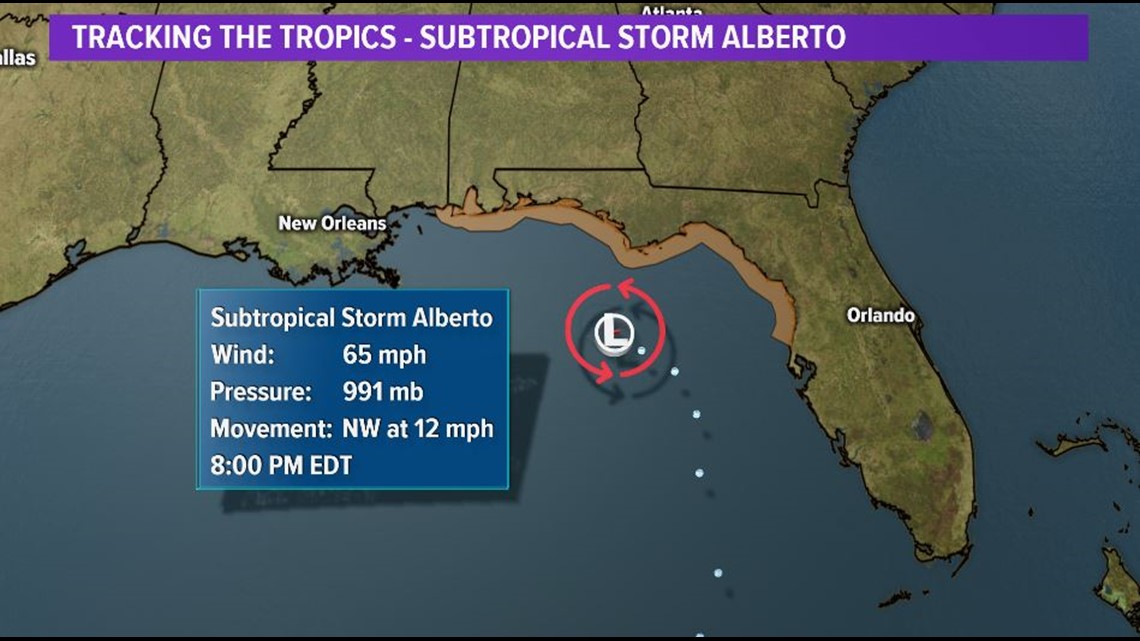
Subtropical Storm Alberto is the 1st named storm of the 2018 Atlantic Hurricane Season and is located in the eastern Gulf of Mexico.
The system has maximum sustained winds of 65 mph and will likely maintain that strength until it makes landfall in the Panhandle of Florida on Monday.
**It is a "subtropical" storm because it is not fully tropical in structure at this time.**
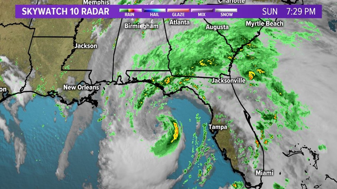
The system will weaken quickly once it is over land and the remnants are expected to move northward until they are absorbed into a large trough of low pressure.
**We do not expect to see any wind impacts from Alberto in East Tennessee.**
Tropical Storm Warnings are in effect from just north of Clearwater northward along the west coast and Panhandle of Florida to the Alabama/Mississippi state line.
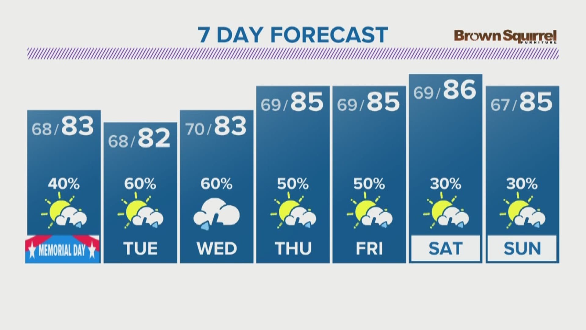
Regardless of how strong the storm becomes, heavy rain, gusty winds and dangerous rip currents will be the main impacts this weekend across the Southeast.
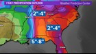
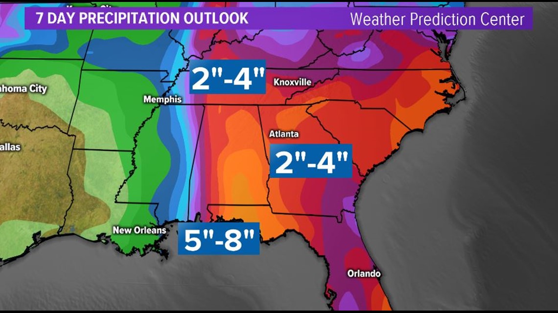
Rain totals over the next 7 days could be as high as 5-8" along parts of the Alabama and Florida Panhandle coasts, with much of the Southeast forecast to see 2-4" of rain.
East Tennessee, southwest Virginia and southeast Kentucky could see 2-4" of rain through the week next week and localized flooding in low-lying and poor drainage areas may become a concern due to the possibility of heavy tropical downpours.
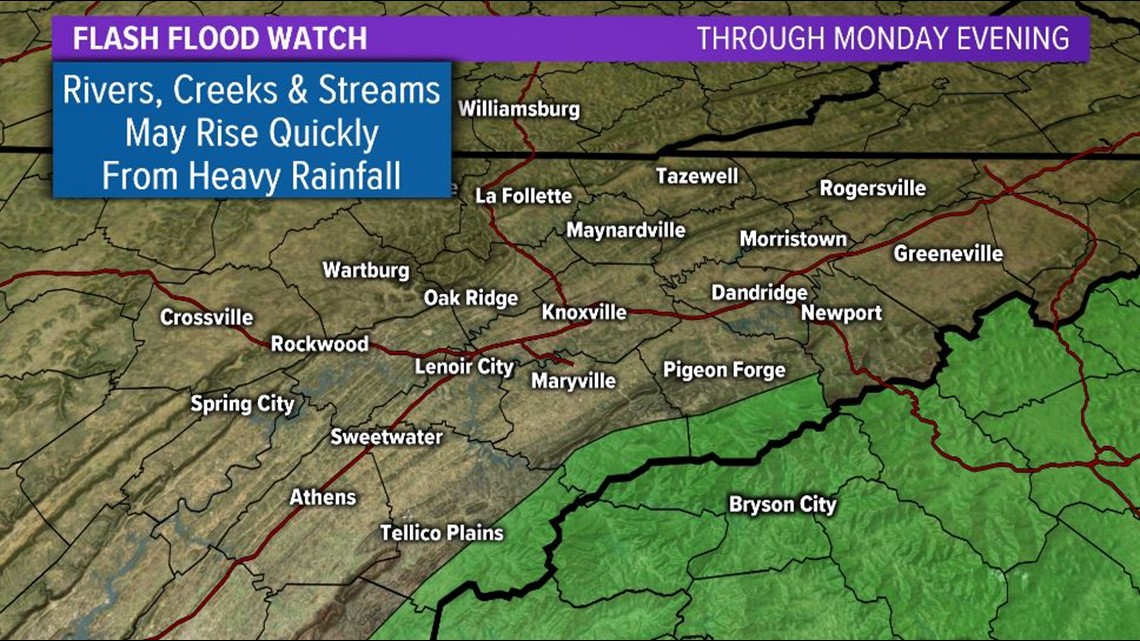
**A Flash Flood Watch is in effect through Monday evening for the Foothills and Smokies of Monroe, Blount and Cocke counties. Heavy rain may cause rivers, creeks and streams to rise quickly and flooding is possible.**

Scattered showers and storms will be possible each day through much of the upcoming week with highs in the lower to middle 80s each day.
It might be a good idea to have indoor options for your Memorial Day plans or if you are going to be outdoors, pay attention to changing weather conditions and remember "when thunder roars, head indoors".
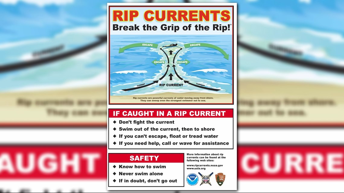
If you have plans to head to the beaches of the Gulf Coast, it is not a good idea to go into the water.
Dangerous rip currents are nearly invisible from the water's edge and can quickly pull you out to sea.
If you get caught in a rip current, "don't fight, swim left or right".
A little tropical history.... It's not entirely uncommon for a named storm to form before the official start of the Atlantic Hurricane Season on June 1.
In fact, a storm develops before June 1 an average of about every 3 to 4 years.
Interestingly, 4 of the last 6 years have had a named storm form before June 1... 2015 and 2017 each had 1 storm and 2012 and 2016 had 2 storms before the season official began. We can now at 2018 to that list.