
OAK RIDGE, Tenn. — The Oak Ridge National Laboratory finished mapping out every building over 450 square feet in the United States on Tuesday.
The project helps FEMA respond more quickly to natural disasters than they could before.
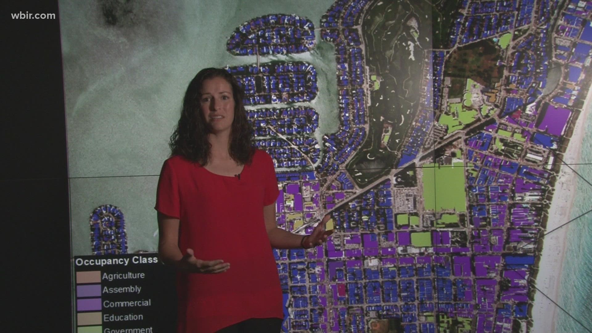
"One thing that's important for FEMA is to know where the buildings are, but what types of buildings are they?" said Melanie Laverdiere a research scientist at ORNL.
When a natural disaster strikes, FEMA uses the database created by the ORNL scientists to decide where they should send resources. The database includes the building location, the type of building, the height and other details.
FEMA then surveys the sites to create maps of damage, color coded from no damage, to completely destroyed.

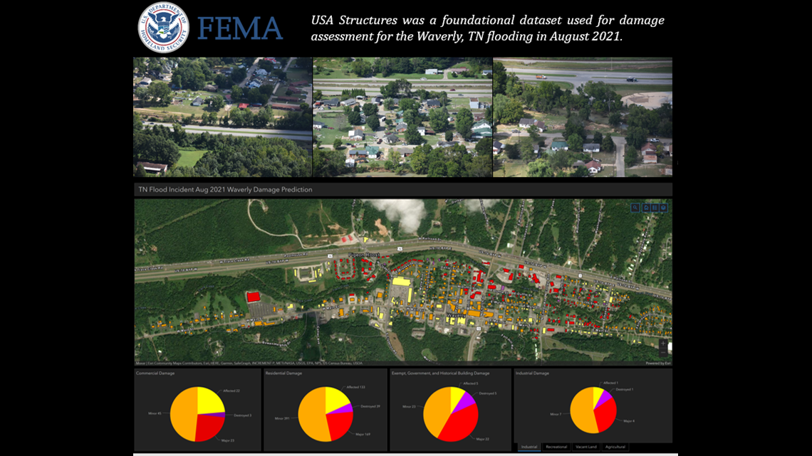
Previously, FEMA had to figure out where buildings were located and their purpose after they responded to a disaster. Now, they already know.
"They have the data sitting on the shelf," said Mark Tuttle, the project manager.
Tuttle said FEMA saw tangible changes after Hurricane Laura devastated Southeast Louisiana last year.
"They actually began disseminating damage assessment checks within a month of the actual event, which is unprecedented. Unheard of," Tuttle said.
"The more detail that you can provide for a building, the better response and recovery efforts that they can perform," said Laverdiere.
The scientists used artificial intelligence and ORNL's supercomputers to catalog buildings based on satellite images.
"Basically, we give the computer the information that we want it to learn," said Laverdiere. "We keep telling it what a building is, what it looks like, and then we let that computer automatically detect buildings across a much larger area."
Both scientists said FEMA is using their database for Hurricane Ida and the wildfires in California.