
KNOXVILLE, Tenn. — Conditions in East Tennessee lately have been warm, dry and sunny — but people haven't been able to truly enjoy the clear blue skies due to a haze. Many wondered if there was a fire nearby darkening the skies.
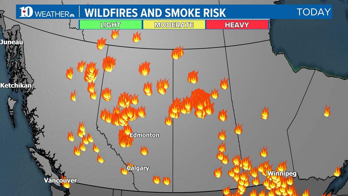
There are fires ongoing, but not anywhere near the Volunteer State. They're far away in Western Canada. Fires in Alberta have become the most renowned, but this heat and drought are also in nearby provinces of British Columbia and Saskatchewan.
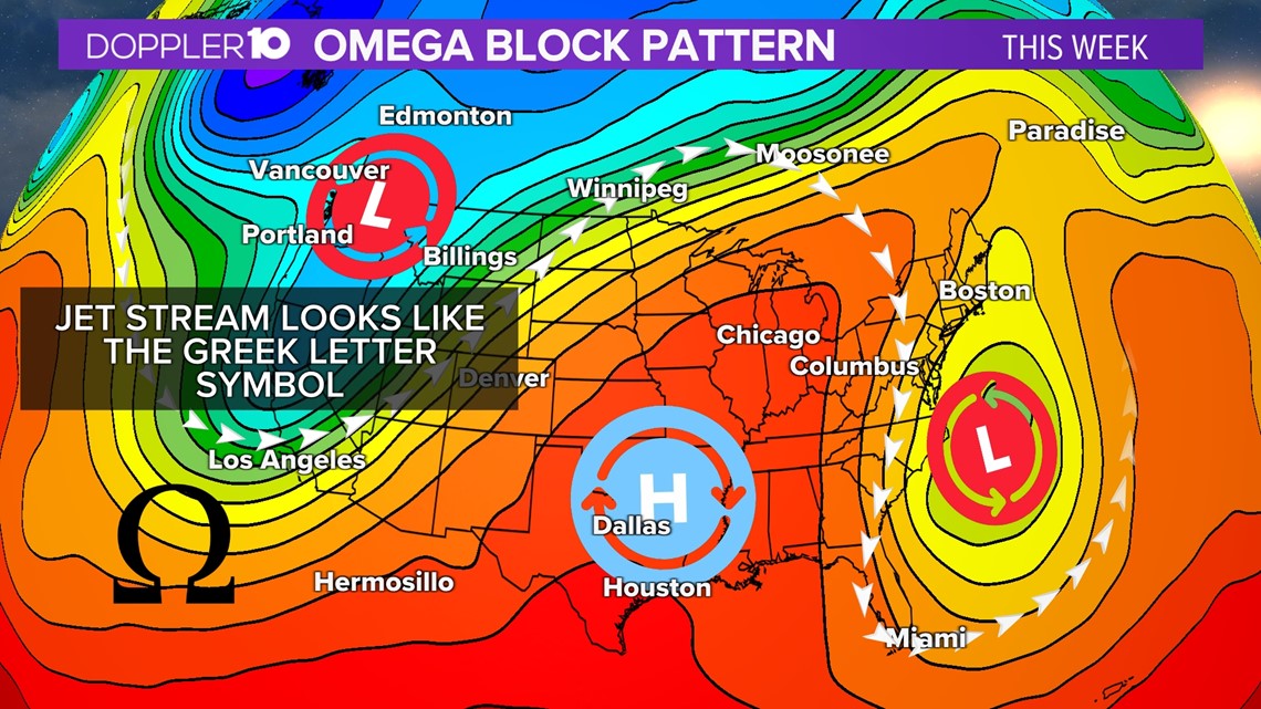
The fires grew during the beginning of May due to intense high pressure from a weather pattern known as an omega block.

An omega block is something seen from the upper levels. It's when low-pressure systems on the west and east sides of North America sandwich in a high-pressure ridge in the center. Once this system sets up, it can lock in for extended periods of time.
With this, Alberta's drought conditions only worsened.

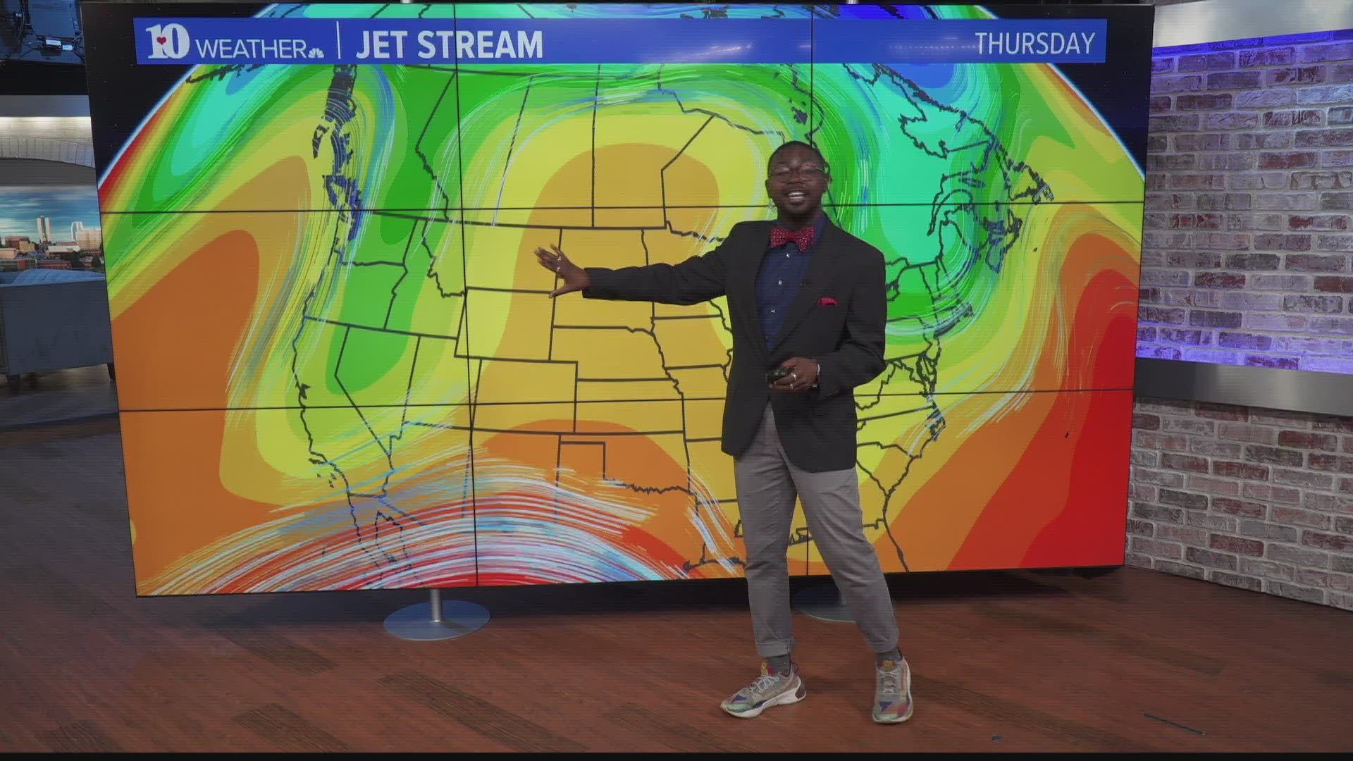
But how exactly does smoke from the West make it all the way over to the Eastern U.S., let alone as far south as Tennessee? The answer is the jet stream.
Rising winds over Western Canada pick up the heavy smoke plumes and carry them along with the clouds and systems as they travel. So, the smoke gets wrapped up and goes wherever the wind blows. Even with an upcoming cold front approaching our area, smoke will be pushed deeper into the South.
This could continue as long as fires are releasing such heavy smoke, but the good news is that it is so high in the atmosphere that it won't affect local air quality.