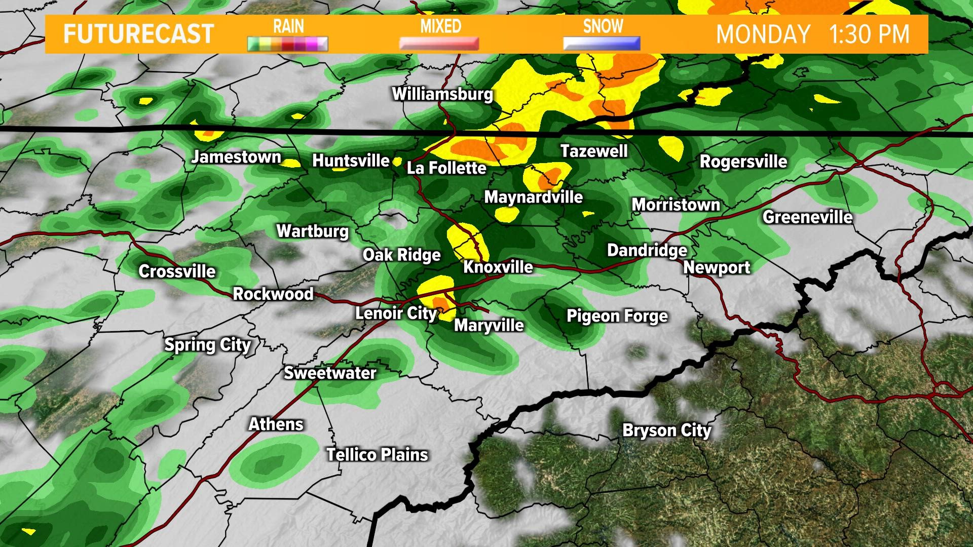
A cold front is forecast to move through the Southeast today and it could bring a few strong storms to parts of Upper East Tennessee.
Potential Impacts:
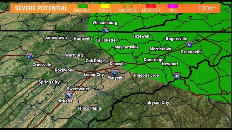
The Storm Prediction Center has placed parts of our viewing area under a "marginal" risk for strong to severe storms.


The main threat will be from the potential for damaging winds but a few isolated tornadoes are not out of the question.
IF we have any spin-ups, they will likely be for areas east of I-75.
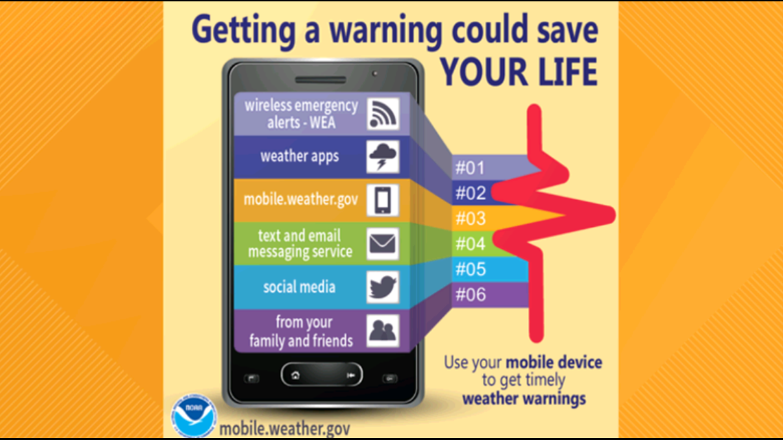
How can you be prepared?
Make sure you have a way to receive weather alerts and advisories. And check back for updates to the forecast!