
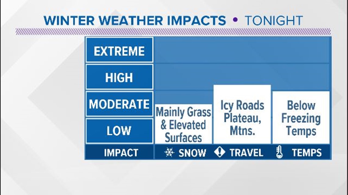
Most of the area looks like a winter wonderland! Accumulations were mainly on grassy and elevated surfaces but we have heard some reports of slick roads.
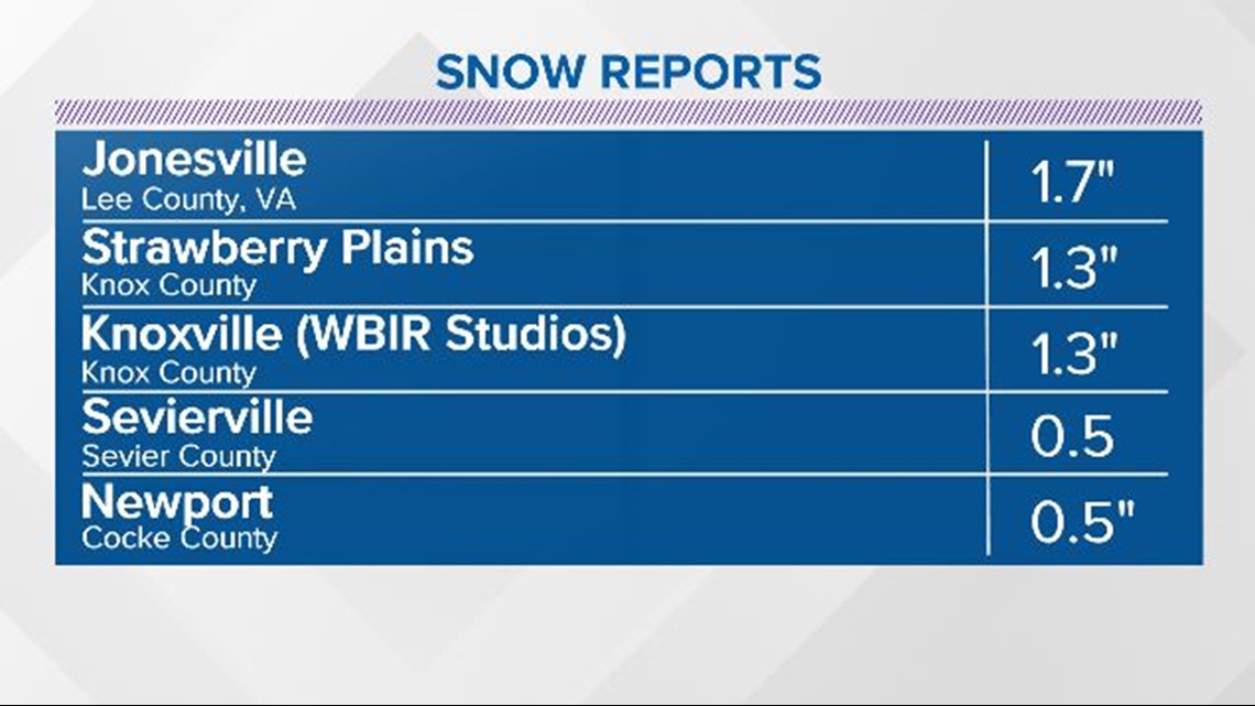
Here are a few of the reports from around the area:

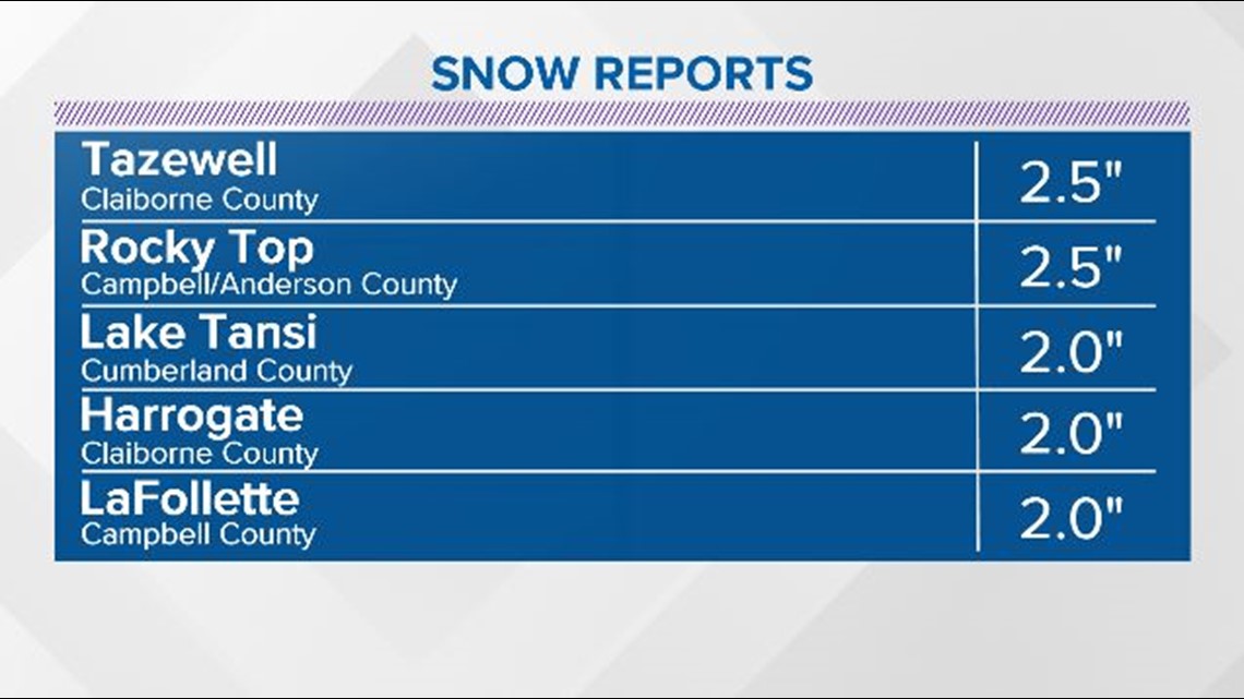

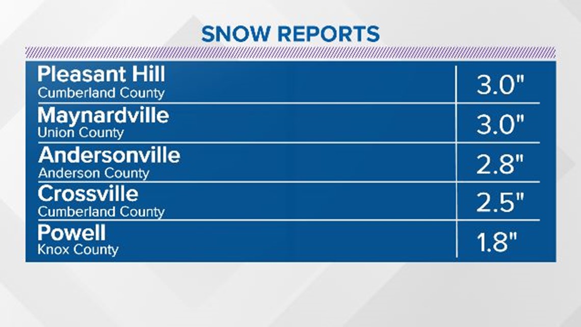

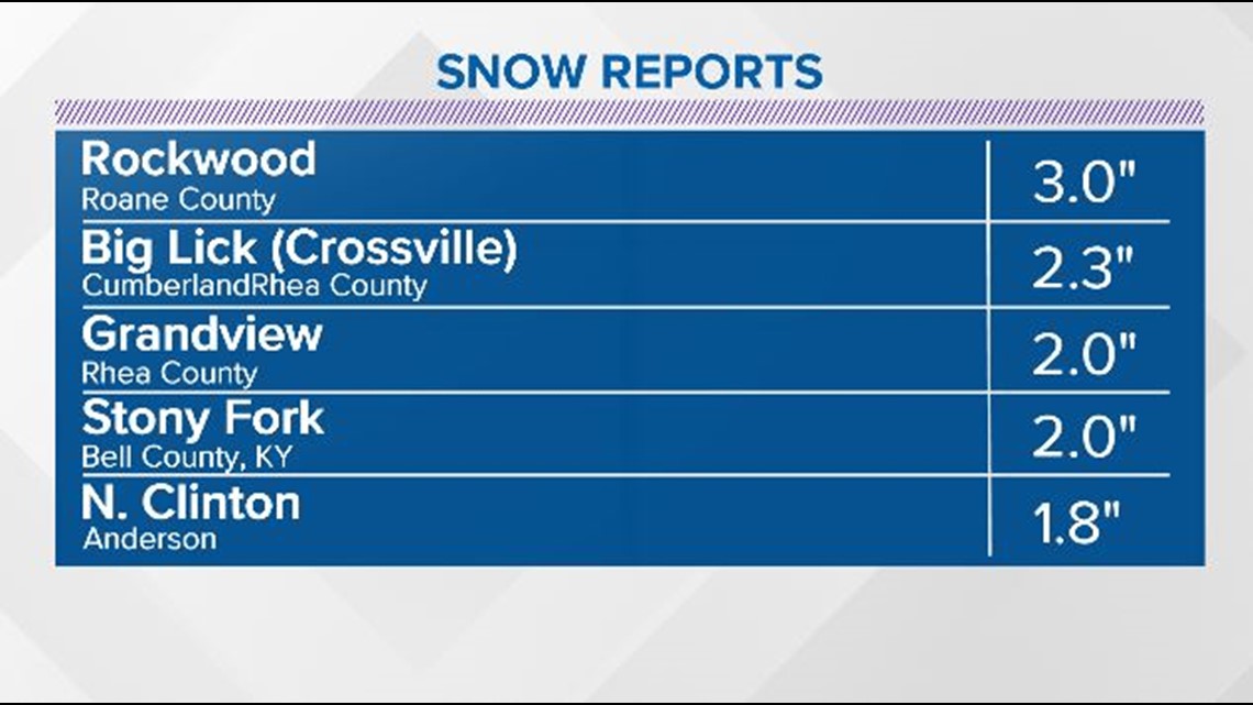

The duration of the event and the chilly air that has moved in has allowed some snow to stick to roads.
Areas with the best chance of seeing some slick or slushy spots are in Cumberland, Fentress, Scott, Morgan, Roane, Anderson, Campbell, Union and Claiborne Counties.

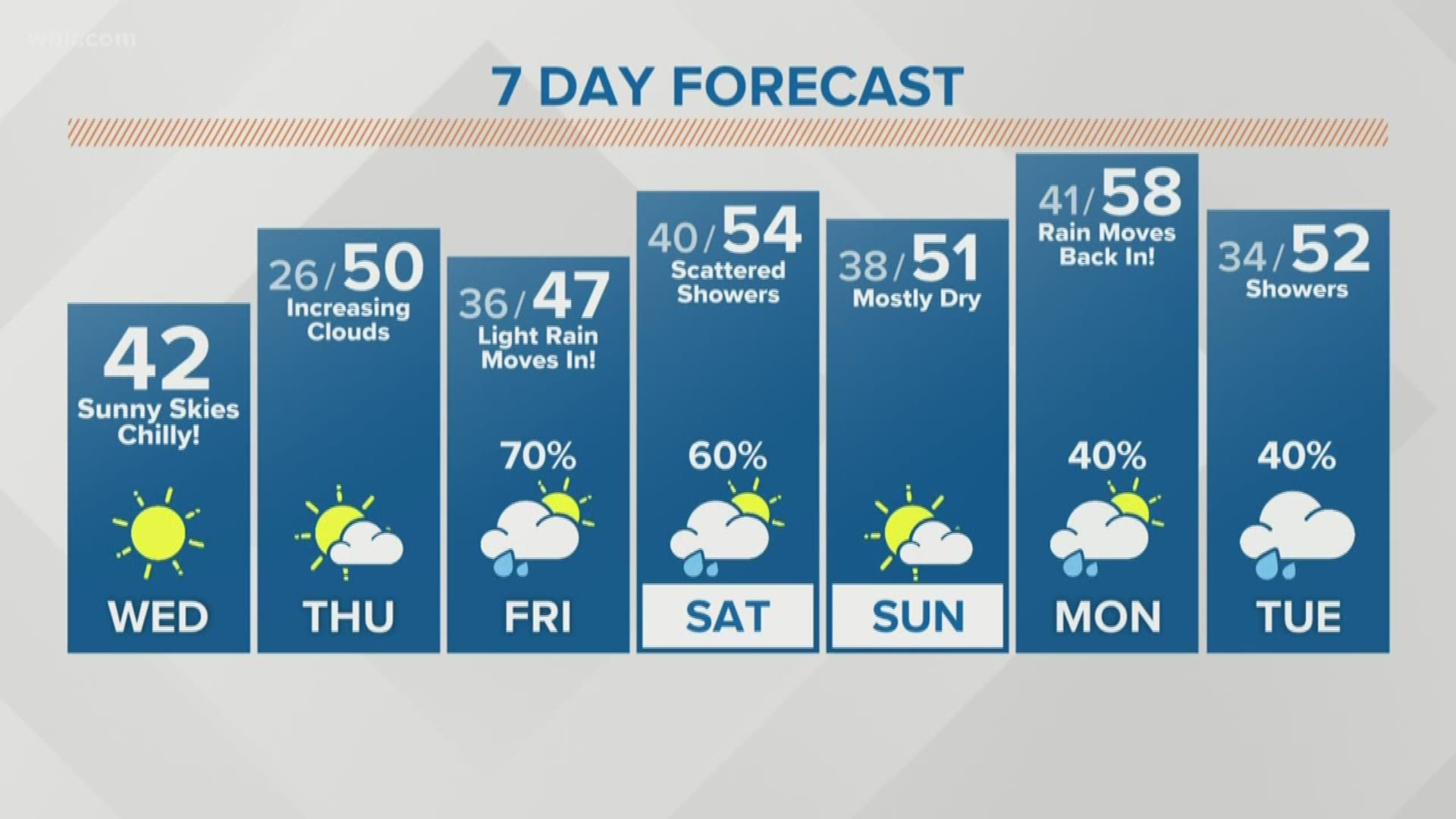
Snow gradually tapered off overnight and all precipitation should come to an end by sunrise Wednesday morning but slick spots will still be possible for the morning commute. Slow down and use extra caution!