TENNESSEE, USA — Winter is just around the corner. So what can we expect during the cold weather season?
WINTER WEATHER OUTLOOK
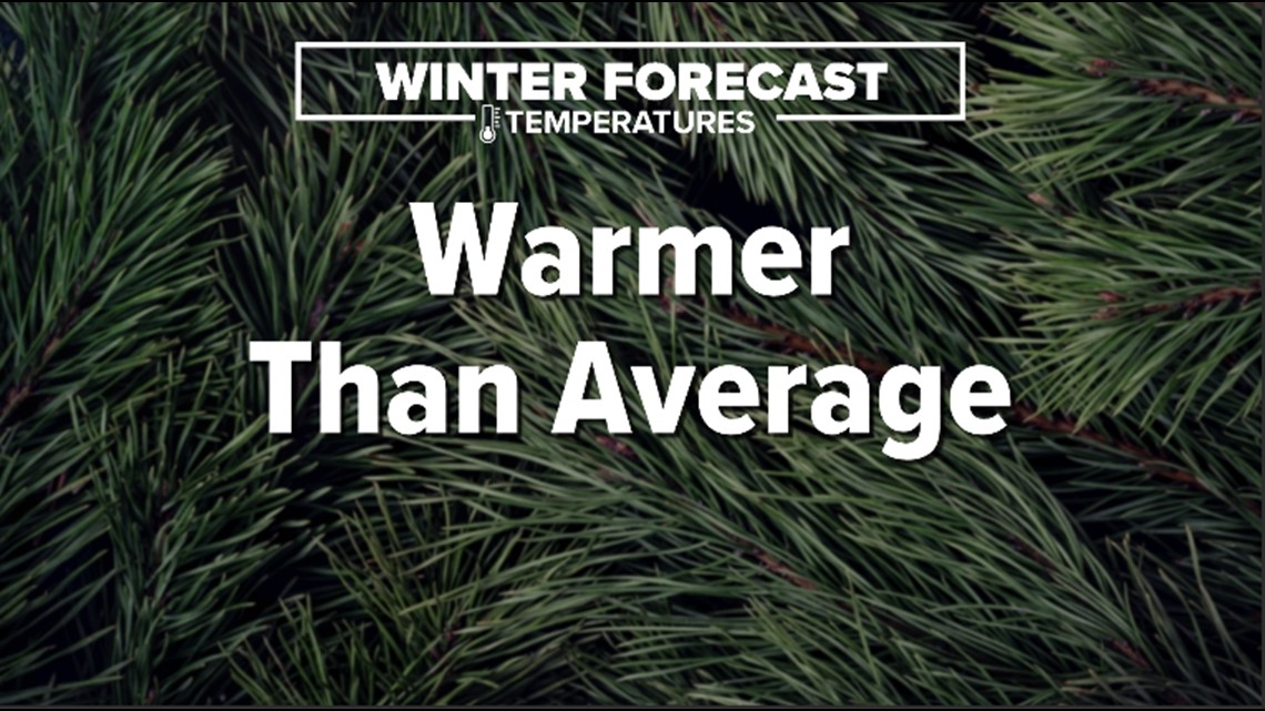
Overall, we are expecting warmer-than-average temperatures through the winter season.

But that doesn't mean that we WON'T have intrusions of cold air. They just have to line up with chances of precipitation for us to have wintry weather.
We are expecting near-average snowfall totals throughout the season.

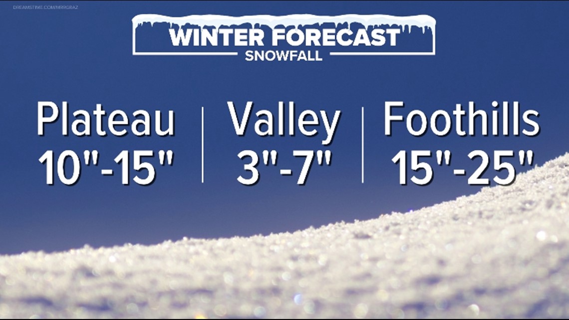
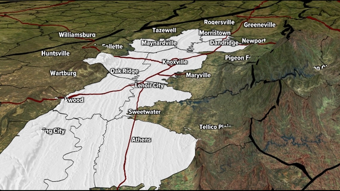
The average seasonal snowfall for Knoxville is 4.6", so when we say 3"-7" for the Valley, the Southern Valley will likely receive snowfall totals closer to the low side of that forecast range.
Following that same line of thought, the Northern Valley will likely be closer to the high side of that forecast range.
Now let's talk about some of the factors that may influence our weather during the winter season.
WHAT IS LA NINA?
Trade winds typically blow from east to west across the Eastern Equatorial Pacific Ocean.
When those trade winds are stronger than normal, they take warm water at the surface away from the coast of South America, allowing cool water to "upwell."
This "cooling" of the water in the Pacific Ocean can affect the large-scale weather pattern, pushing the jet stream farther north than normal.

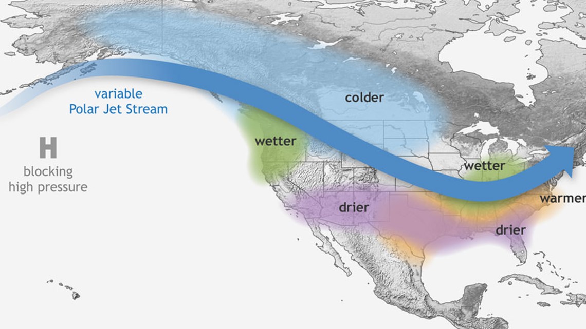
For the United States, this usually means colder-than-average conditions for the Northern Plains and warmer-than-average temperatures for the southern tier of the Lower 48.
The same areas that are typically warmer are also usually drier during a La Nina pattern.
Wetter-than-average weather is expected in the Pacific Northwest and in the Ohio and Mississippi River Valleys.
So for East Tennessee, we kind of get stuck in the middle.
We are expecting wetter-than-average conditions and if there happens to be cold air in place at the same time, this could lead to some wintry weather.
It should also be noted that two other climate patterns, the Arctic Oscillation and the North Atlantic Oscillation, also play a big role in allowing cold air to come to the Southeast.
Unfortunately, these two patterns are only able to be forecasted about two weeks in advance.
So when we talk about averages, what is average?
AVERAGE SNOWFALL
Here are the average snowfall totals for the winter seasons during the 30-year period of 1991-2020:

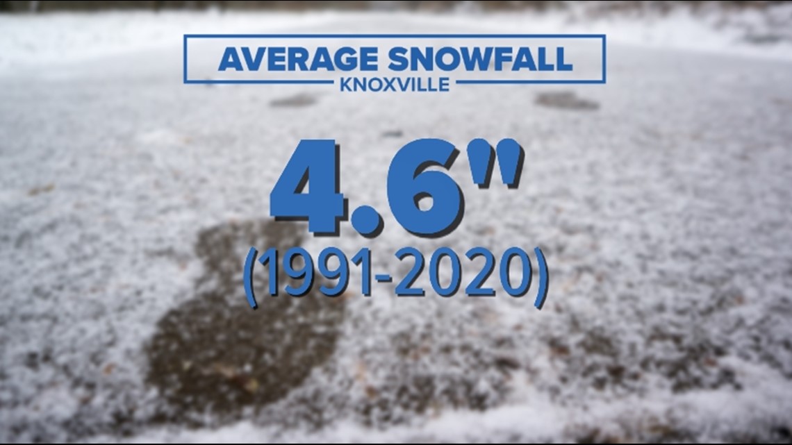

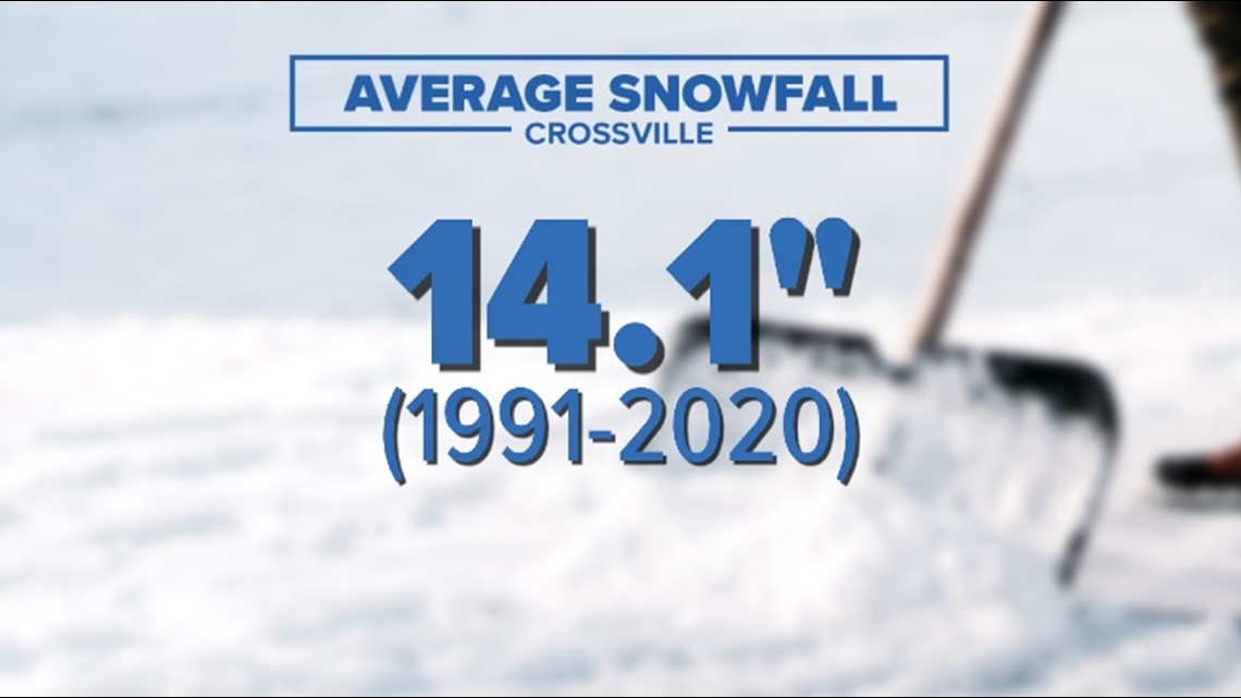

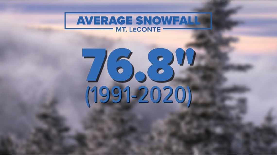
These snowfall averages vary due to the topography of East Tennessee.
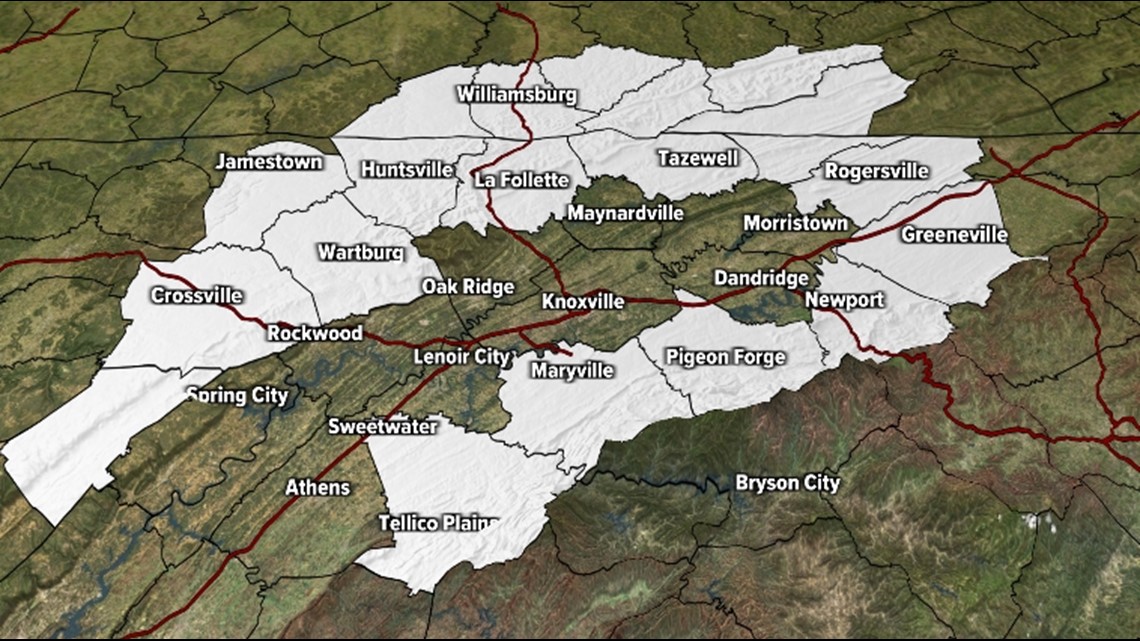
TOPOGRAPHY
You can divide East Tennessee into three distinct topographic regions:
The Valley: Includes the lower elevations from Hawkins, Hancock and Claiborne counties down through Rhea, Meigs and McMinn counties.

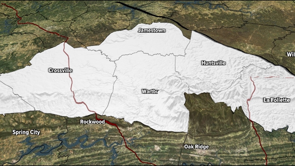
The Plateau: An area higher elevation that includes Cumberland, Fentress, Scott Morgan and Campbell counties.

The Foothills/Mountains: The highest elevations include our eastern border from Monroe to Greene County.
Together, the Plateau, Southeast Kentucky and the Mountains make up the "horseshoe" that typically receives more snow than the lower elevations in the Valley.