
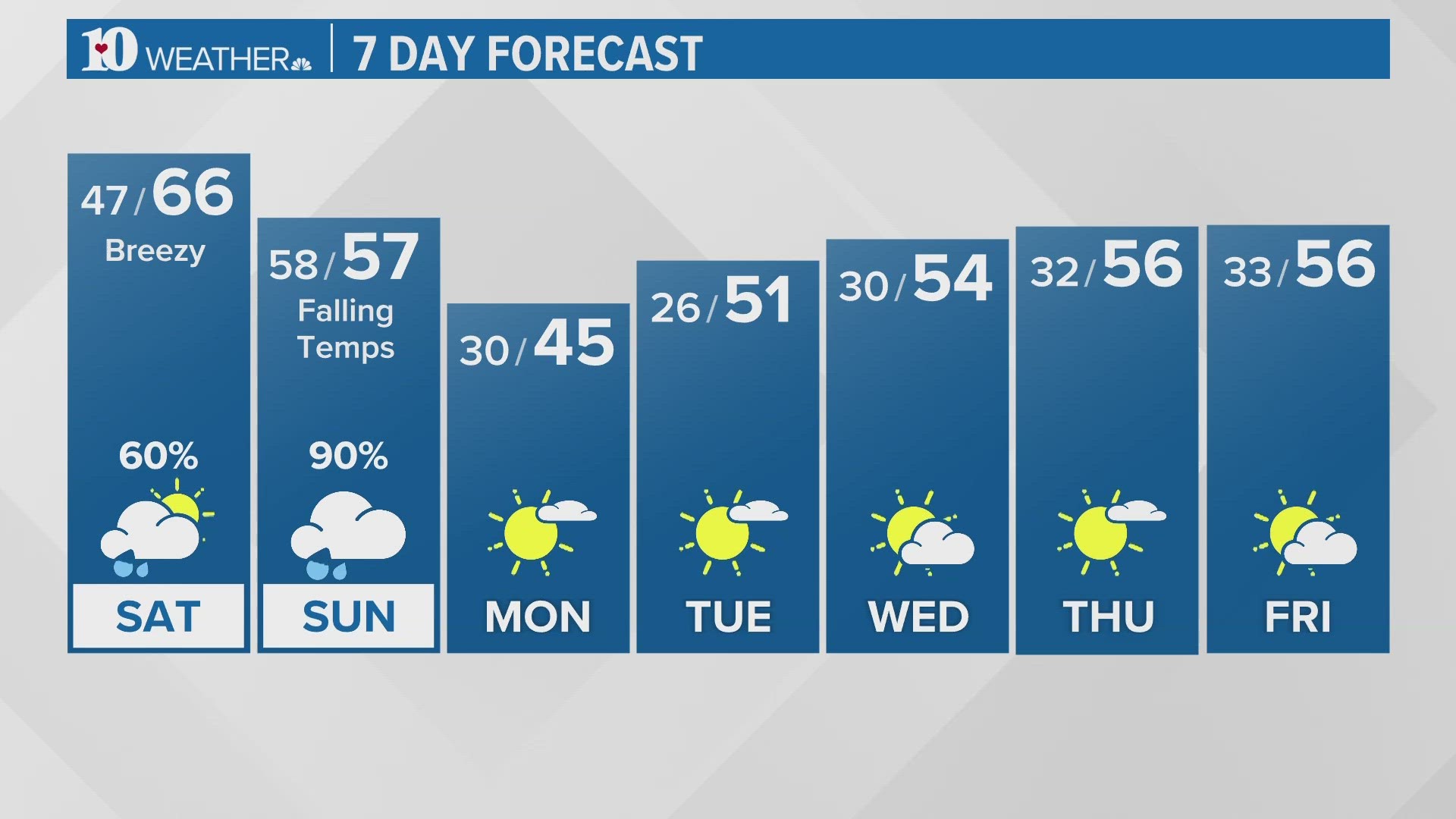
KNOXVILLE, Tenn. — A strong low pressure system moving out of the Plains will tap into moisture from the Gulf of Mexico and bring the potential for heavy rain, gusty winds and wintry weather to East Tennessee this weekend.
WIND
As the low strengthens to our west on Saturday, winds will increase across our area.
Gusts up to 50 mph are possible in the Mountains and Foothills late Saturday and overnight into Sunday, while the Plateau could see gusts of 35 to 40 mph.
Winds will be breezy in the Valley as well so make sure you secure any loose objects (like holiday decorations) on your property.
A Wind Advisory was called for Saturday evening through Sunday morning for the mountain wave wind event that will occur. Winds from the southeast will come aggressively down the Mountains and into the Foothills during this time.

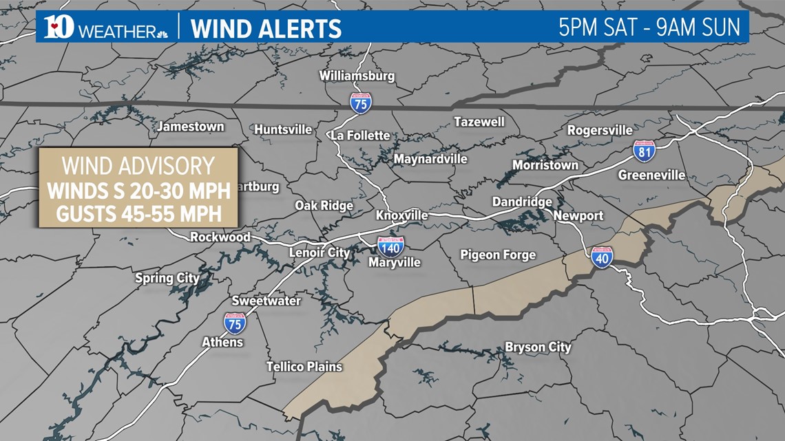
Thankfully, heavier rainfall in the mountains overnight could work to override the winds trying to lighten rainfall totals.
RAIN
Scattered showers are possible through the day Saturday but the heaviest and most widespread rain won't arrive until late Saturday night into Sunday morning.
A line of strong storms will develop to our west on Saturday and weaken as it moves east through Middle Tennessee.
However, a few of those strong storms could reach our Plateau and Valley counties late Saturday evening, bringing the potential for gusty winds and an isolated tornado to the areas shaded in green (below).

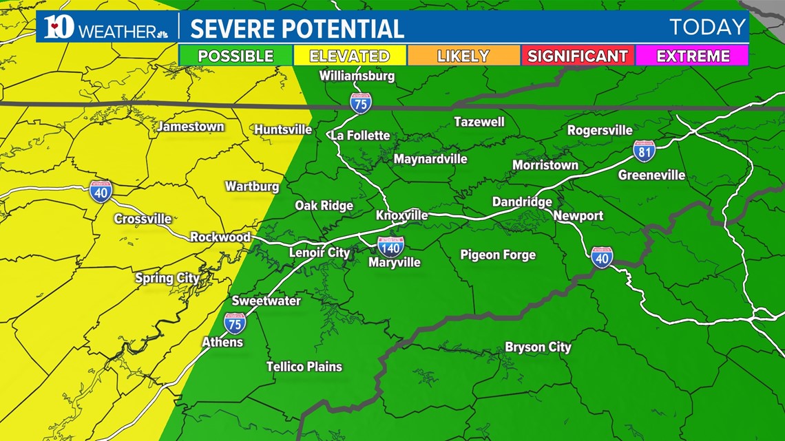
As of now, we expect the line to weaken as it moves into the Valley but gusty winds are still expected area-wide overnight into Sunday, even outside of any storms.
Rainfall totals of 1"-2" are likely from late Saturday night through the day Sunday.

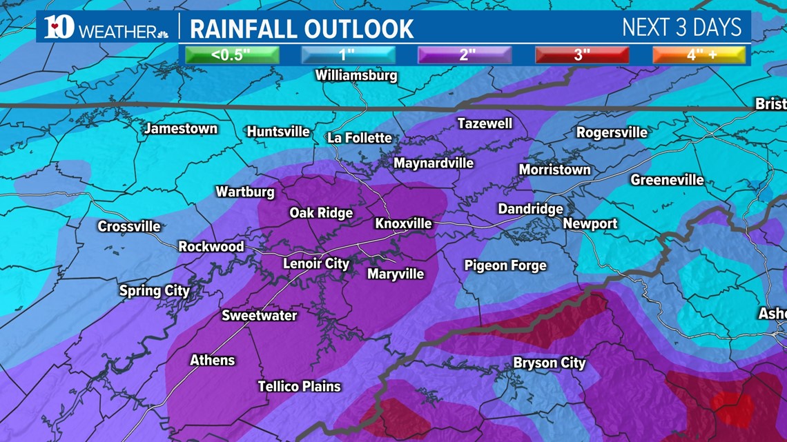
While this is great news for the current drought conditions, it might be a little too much of a good thing in such a short period of time and localized flooding may be possible in low-lying and poor draining areas.
SNOW
Colder air will move in on gusty winds through the day Sunday so while we likely start the day in the mid-50s, temperatures will fall steadily through the afternoon with gusty winds making it feel even colder than it actually is outside.
There is the potential to see lingering rain showers to transition to snow from west to east Sunday afternoon and evening.
The window of opportunity to see wintry weather will be narrow since the moisture is moving out as the cold air arrives but folks on the Plateau, in the Northern Valley (from Morristown northeast) and in Southeast Kentucky could see a dusting to 0.5".


Areas above 2,500 feet in our eastern counties could see 1"-2" of accumulation with higher totals possible in elevations above 4,000 feet.
We may even see a few flurries in the Central Valley!
We'll have more details as we get closer to the event so please check back for updates!