
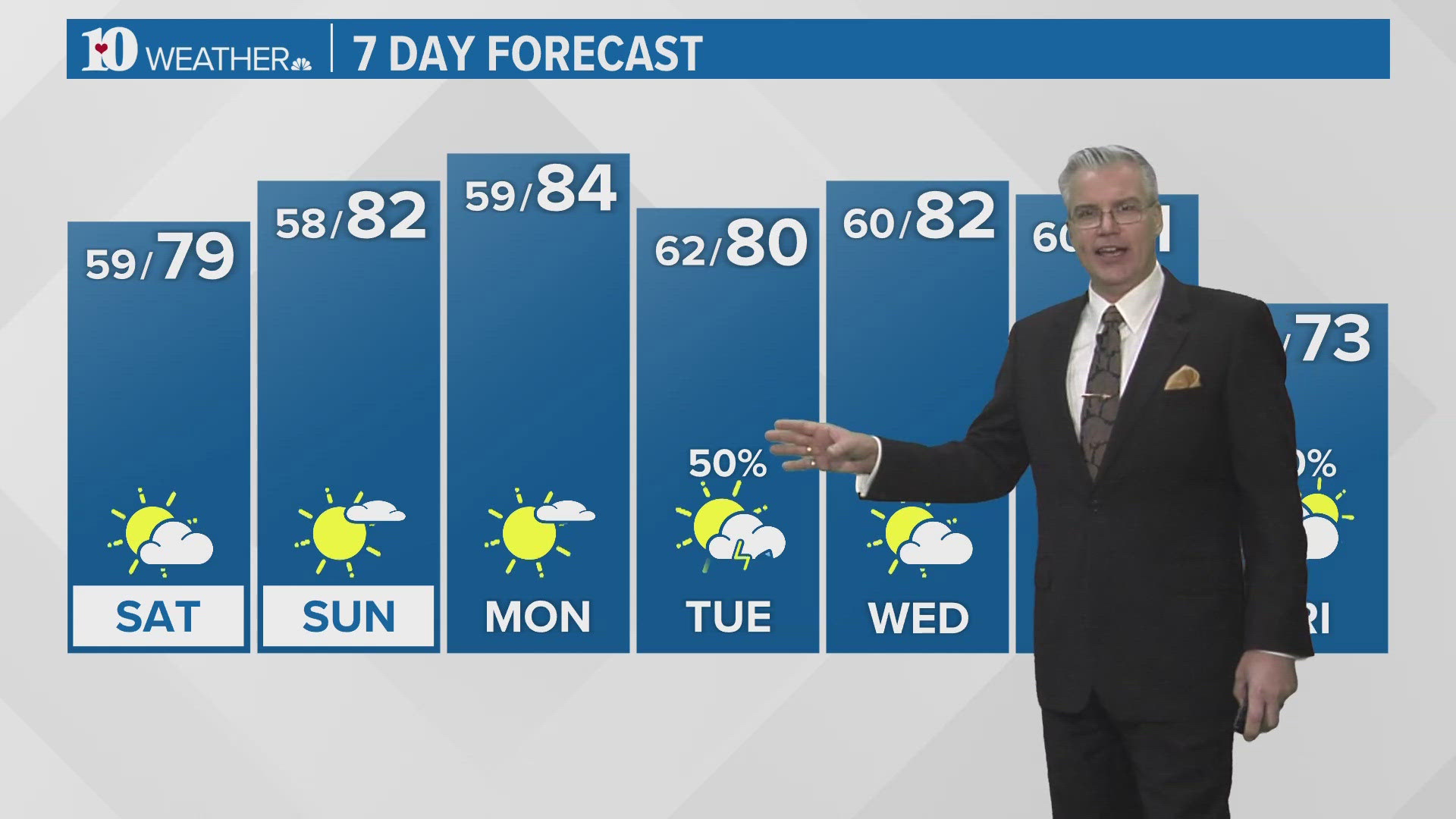
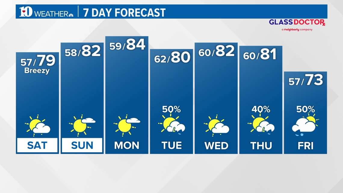
TENNESSEE, USA — Tonight: Partly cloudy. Lows in the upper 50s.
Saturday: Partly cloudy, breezy and warmer. Highs in the upper 70s. Lows in the upper 50s Saturday night.
Sunday: Mostly sunny and warm. Highs in the lower 80s. Lows in the upper 50s Sunday night.
Monday: Mostly sunny and warm. Highs in the middle 80s. Lows in the lower 60s Monday night.
Tuesday: Mostly cloudy with scattered thundershowers possible. Highs close to 80 degrees. Lows near 60 degrees Tuesday night.
Wednesday: Partly cloudy. Highs in the lower 80s. Lows near 60 degrees Wednesday night.
Thursday: Increasing clouds with a chance for scattered thundershowers late. Highs in the lower 80s. Lows in the middle to upper 50s Thursday night.
Friday: Mostly cloudy with scattered showers and isolated storms possible. Highs in the lower to middle 70s.
Have a great Weekend!!!

Download our free WBIR weather app (Apple, Google Play) with interactive radar and follow us on social media!
WBIR Weather on Facebook
WBIR Weather on X
Todd Howell on X
Rebecca Sweet on X
Tevian Whitehurst on X
Cassie Nall on X
Mike Simon on X
Make it easy to keep up-to-date: Download the WBIR 10News app now and sign up for our Take 10 Lunchtime Newsletter.
Have a news tip? Email 10Listens@wbir.com, or visit our Facebook page or Twitter feed.