KNOXVILLE, Tenn. — **A Tornado Watch was issued until 2 a.m. on April 3 for all counties of East Tennessee, as well as Lee County in Virginia. The NWS included Blount County, TN, Rhea County, TN, Knox County, TN, Campbell County, TN, Bledsoe County, TN, Sevier County, TN, Morgan County, TN, Meigs County, TN, Scott County, TN, Monroe County, TN, Jefferson County, TN, Roane County, TN, Loudon County, TN, McMinn County, TN, Anderson County, TN, Union County, TN in the list.**
At around 10:47 p.m., the National Weather Service said an existing Tornado Watch for some East Tennessee counties was canceled. The Tornado Watch stayed in place for several other East Tennessee counties.
At around 7:14 p.m. the National Weather Service issued a Tornado Warning for Harlan County and Bell County in Kentucky after storms led to tornado damage in East Tennessee. The NWS said it was issued for East-central Bell County and all of Harlan County. It said a radar indicated rotation in an incoming storm.
The National Weather Service previously issued Tornado Warnings for parts of Northern Morgan County, Southwestern Campbell County and Central Scott County on Tuesday. Later, that warning was extended to Claiborne County. By 6:40 p.m., the NWS said the Tornado Warning had expired.
It also put all of East Tennessee under a Tornado Watch until 2 a.m. Wednesday morning.
It said at 5:07 p.m. a severe thunderstorm capable of producing a tornado was located northwest of Wartburg, moving northeast. It said radar indicated rotation in the storm, and said quarter-sized hail could be a hazard.
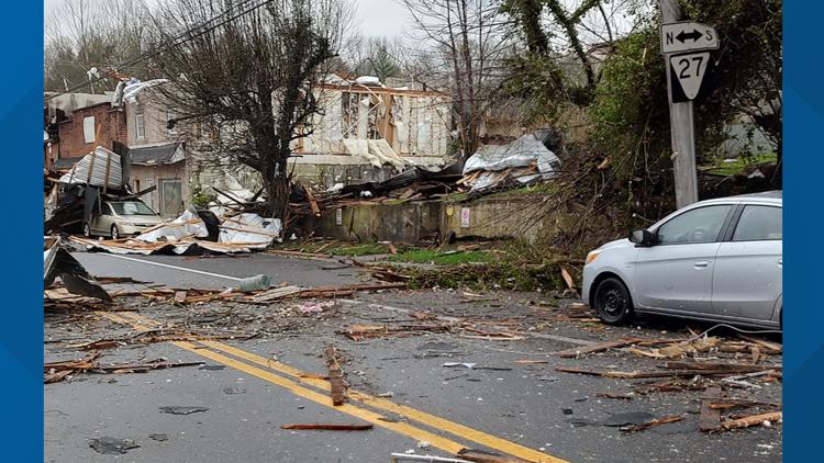
At around 5:33 p.m., the NWS said it confirmed a "large and extremely dangerous tornado" around 13 miles north of Wartburg, moving northeast at around 30 mph.
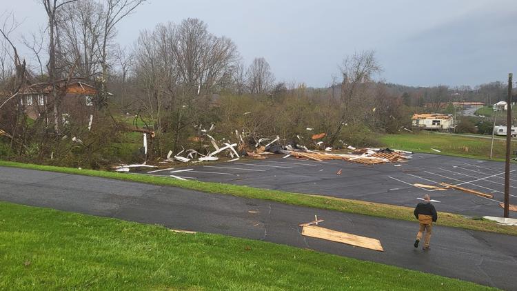
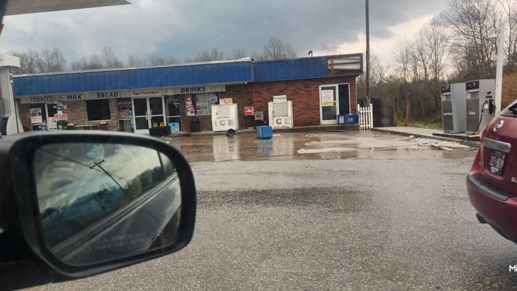
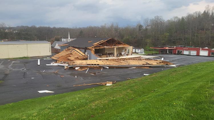
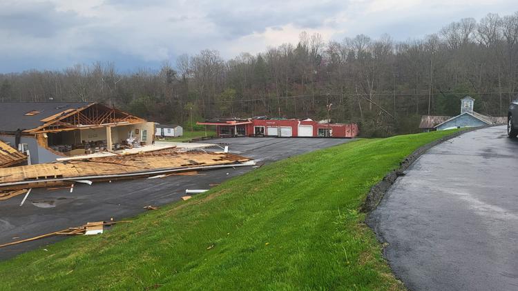
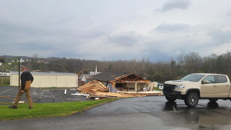
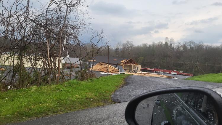
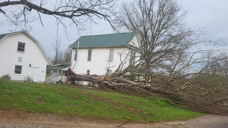
At around 5:42 p.m., the NWS said there was heavy damage reported from Schuberts Funeral Home. The MoCo Mutts Rescue Center while it had debris in the year, its building was still standing and its dogs were safe.
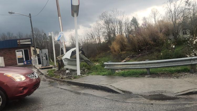
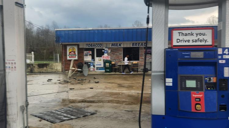
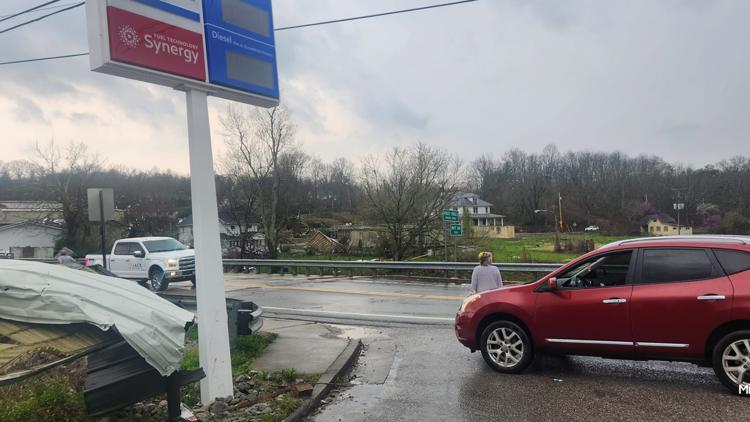
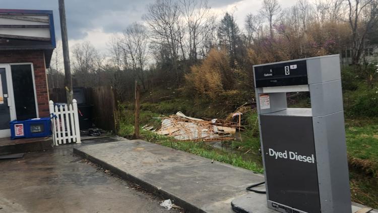
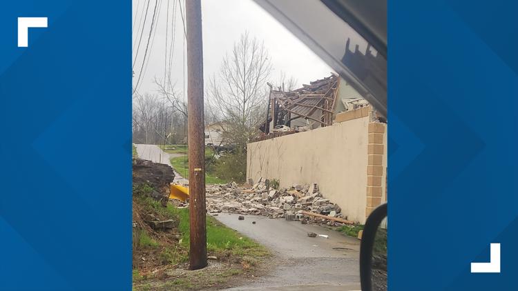
Photos: Sunbright Tornado Damage (4/2/2024)


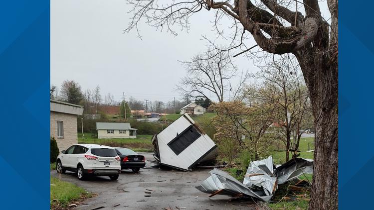

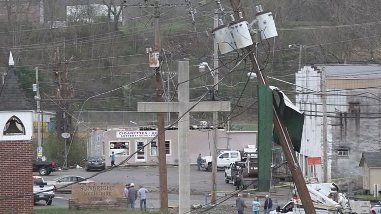


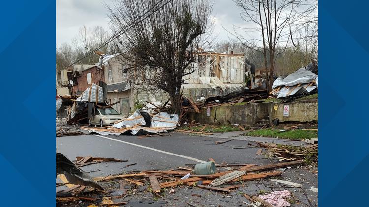

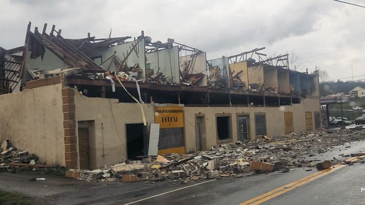


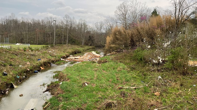

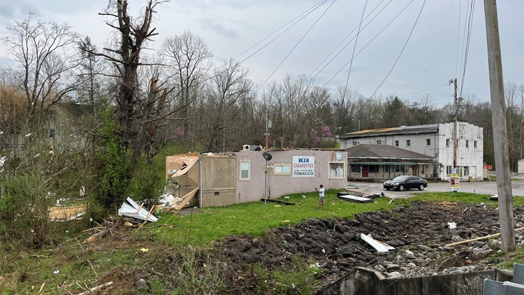
An emergency shelter was also set up at Central High School in Wartburg to help people in the Sunbright community affected by the storm. The American Red Cross said at around 8:18 p.m. that around 50 families arrived for help at the shelter.
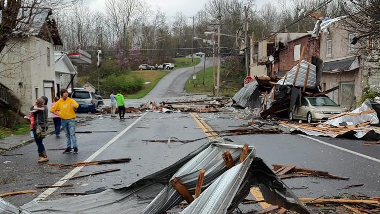
The NWS also said at 6:01 p.m., "a confirmed large and extremely dangerous tornado" was located near Jacksboro, or near La Follette." At 6:10 p.m., it also said a tornado was confirmed near La Follette moving northeast.
---
ORIGINAL STORY
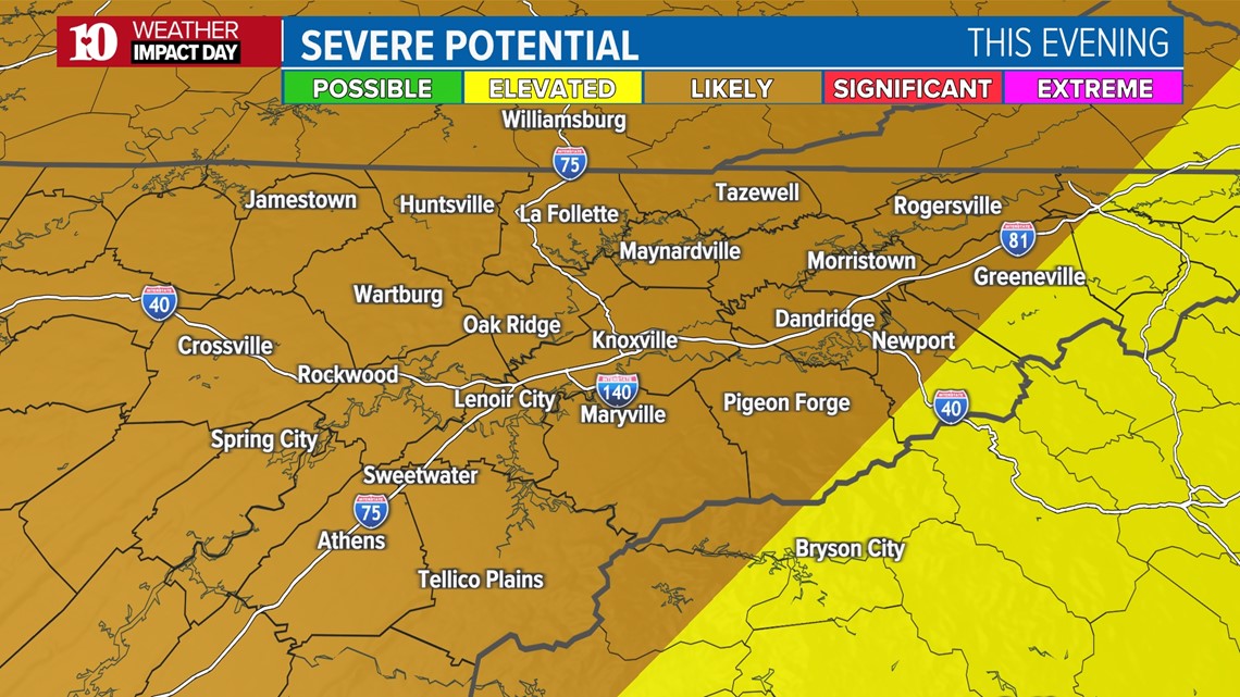
Spring is severe weather season in East Tennessee and we have a chance for strong storms in the forecast this evening.
A strengthening low-pressure system moving through the Ohio Valley will drag a cold front across East Tennessee and with warm and muggy air in place, strong to severe storms may develop later this afternoon and evening.
The National Weather Service has issued a Tornado Watch for Cumberland and Fentress Counties until 9 p.m. CDT. A Tornado Watch is also in effect for South East Kentucky until 8 p.m. EDT.
The Storm Prediction Center has highlighted almost our entire viewing area under a Level 3 risk, meaning that severe weather is "likely" in the areas shaded darker orange.

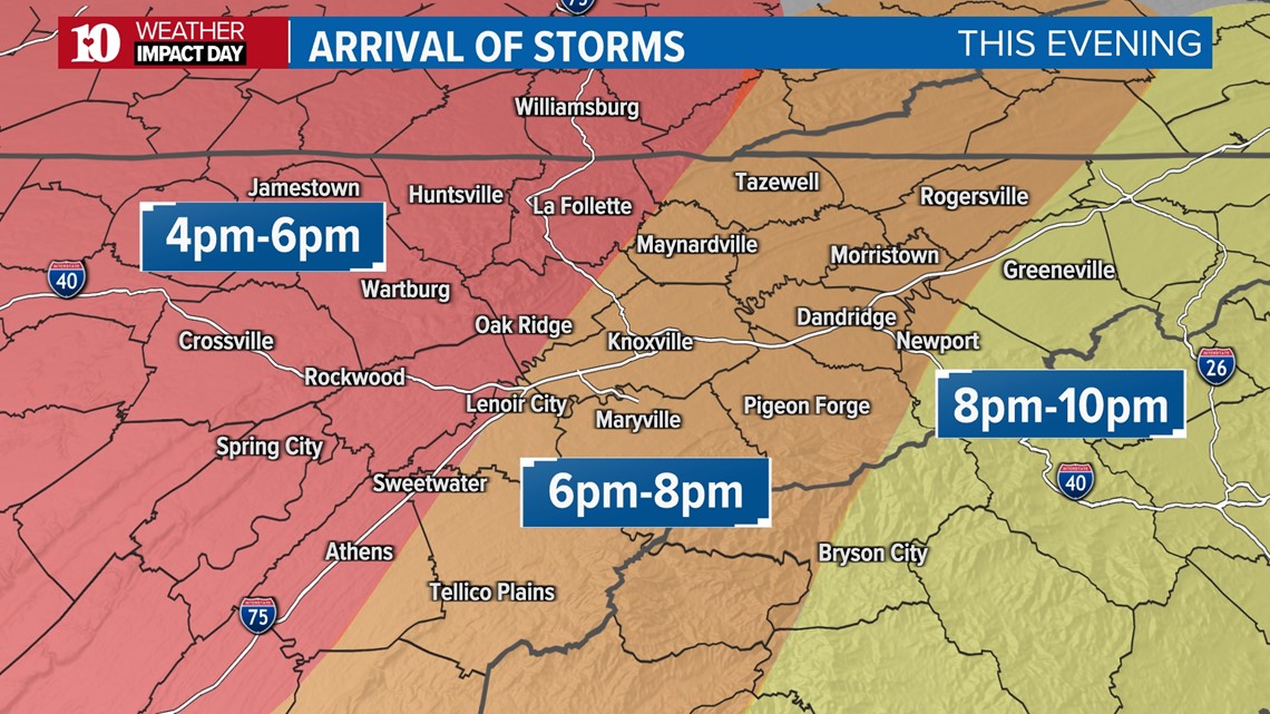
TIMING
A few showers and storms are possible through the day with breezy winds out of the southwest gusting as high as 30 mph.
The threat of severe weather will increase through the afternoon and evening as a line of storms develops in Middle Tennessee and moves eastward into our area.
As of now, it looks like this line could arrive on the Plateau during the late afternoon and spread into the Valley through the evening, possibly lasting into the early overnight hours.

POTENTIAL IMPACTS
Damaging winds are the main threat but hail and a few tornadoes are also possible across all parts of our viewing area.

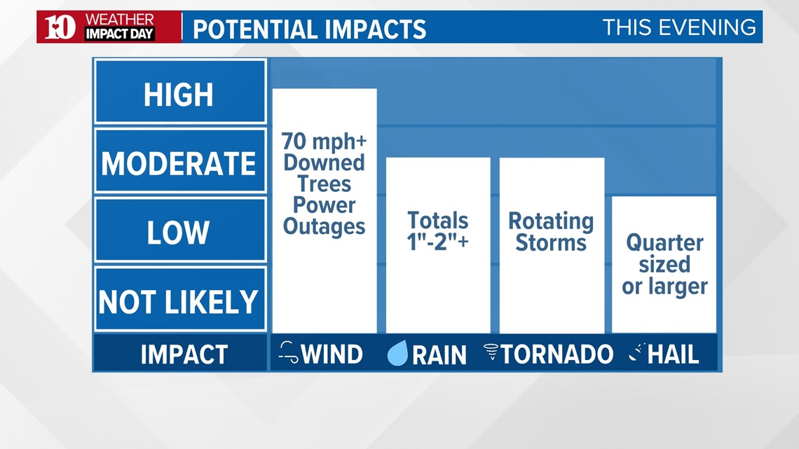
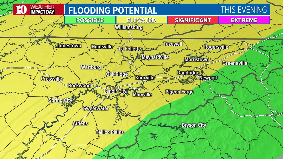
Heavy rain could also cause localized flooding, especially in low-lying and poor-drainage areas.

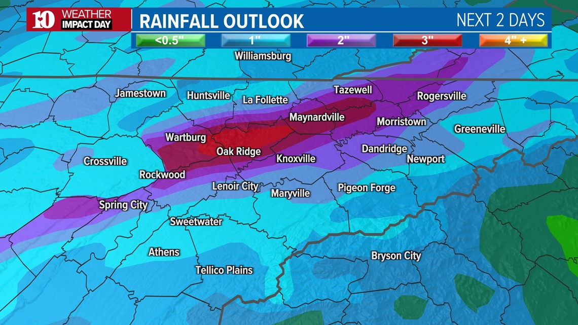
Rainfall totals of 1"-2"+ are possible through early Wednesday morning.

Make sure you have multiple ways to receive weather alerts and please check back for updates as we continue to refine the details of this event!
KNOW YOUR SAFE PLACE
A basement is the best place to be in severe weather, but not everyone has that option. There are other places to seek shelter and areas to avoid.

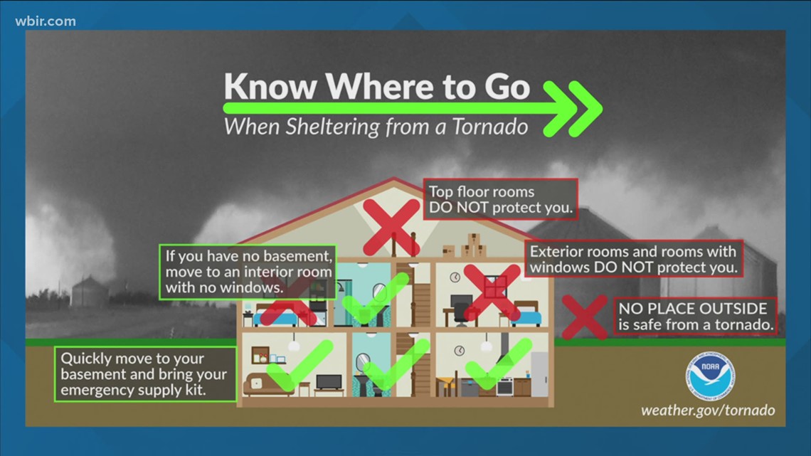
First, stay away from rooms with windows. If a strong gust of wind blows through, even without a tornado, it could shatter the glass and send it flying across the room.
Rooms with outside walls also are dangerous. Even without windows, they won’t stand a chance in a tornado.
Don’t even consider an upper-story floor. It will be the next thing to go after the roof.
An interior bathroom, closet, or laundry room are places to consider.
When you reach your safe place, get as low as you can to the ground and cover your head. It’s also a good idea to grab a pillow or something else padded for additional protection from flying glass or objects.
If there’s a tornado watch, it’s a good idea to go through your safe place and make sure it’s ready to access quickly. Remove any unnecessary objects from the room and ensure there’s a clear path inside.
If you live in a mobile home, you should consider going to a safer location -- find a designated shelter or nearby sturdy structure where you can take refuge in.
AFTER THE STORMS
Once the threat of strong storms ends tonight, colder air will move into the region for the rest of the week with frost or possibly a freeze likely Friday, Saturday and Sunday mornings.