

KNOXVILLE, Tenn. — A strong low-pressure system moving from the Gulf Coast to the Ohio Valley will bring impactful weather to East Tennessee.
Winds will increase across the area through the rest of the day with peak gusts expected from midnight tonight into Tuesday afternoon.
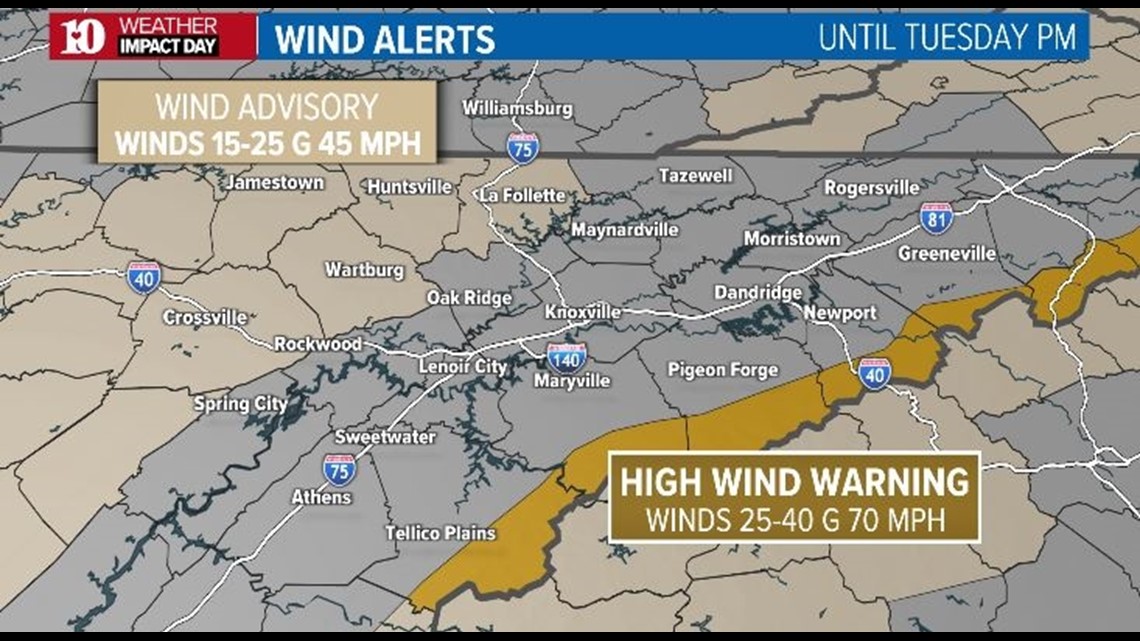
A Wind Advisory (areas shaded in light tan below) has been issued for Cumberland, Fentress, Scott, Morgan and Campbell counties until Tuesday afternoon for gusts up to 45 to 50 mph.
The strongest winds will occur in the Foothills and Mountains along the Tennessee/North Carolina state line. A High Wind Warning (area shaded in gold) is in effect until Tuesday afternoon for wind gusts up to 70 to 80 mph possible in elevations above 2,500 feet.

Downed trees and power lines will be a big concern and the National Park Service has already closed several campgrounds and most roads in Great Smoky Mountains National Park in anticipation of impacts from this wind event.
Sevier County Electric System said it cut power to some parts of the GSMNP Monday out of precaution in order to prevent downed electrical wires from sparking up fires. That area included Elkmont and Metcalf Bottoms.
"As forecasted, the wind is coming across the mountains and dropping in, that'll be the first place it'll hit. So we picked those and it's the, it impacts the least amount of people," Allen Robbins, CEO of SCES said.
The CEO said more populated areas like Townsend and Gatlinburg have put other safety precautions in place.
Due to the ongoing drought conditions, the fire danger will be extremely high across the entire viewing area. Fires will be able to develop easily and spread very quickly in these conditions. If you live near an ongoing fire or start to see smoke, it may be a good idea to have a "go bag" ready in case you need to evacuate the area with short notice.
Rain will eventually arrive from west to east late tonight but may take longer to develop in the Foothills and Mountains due to strong down-sloping winds. Rainfall totals are expected to be around half an inch for most locations but some lucky areas may see closer to one inch of rain.

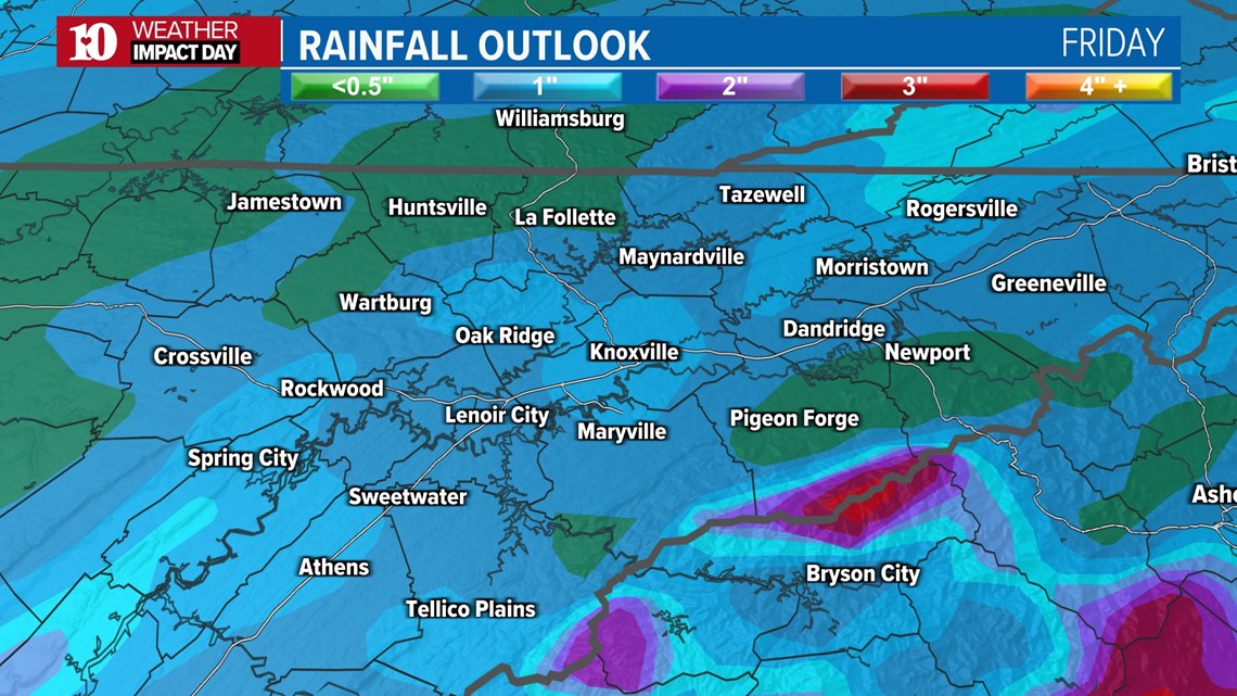
While this won't be a "drought buster" event, it will certainly help to reduce the fire danger across the region for a few days.
The Weather Prediction Center has even highlighted the Foothills and Mountains under their Excessive Rainfall Outlook for the potential of isolated flooding on Tuesday.

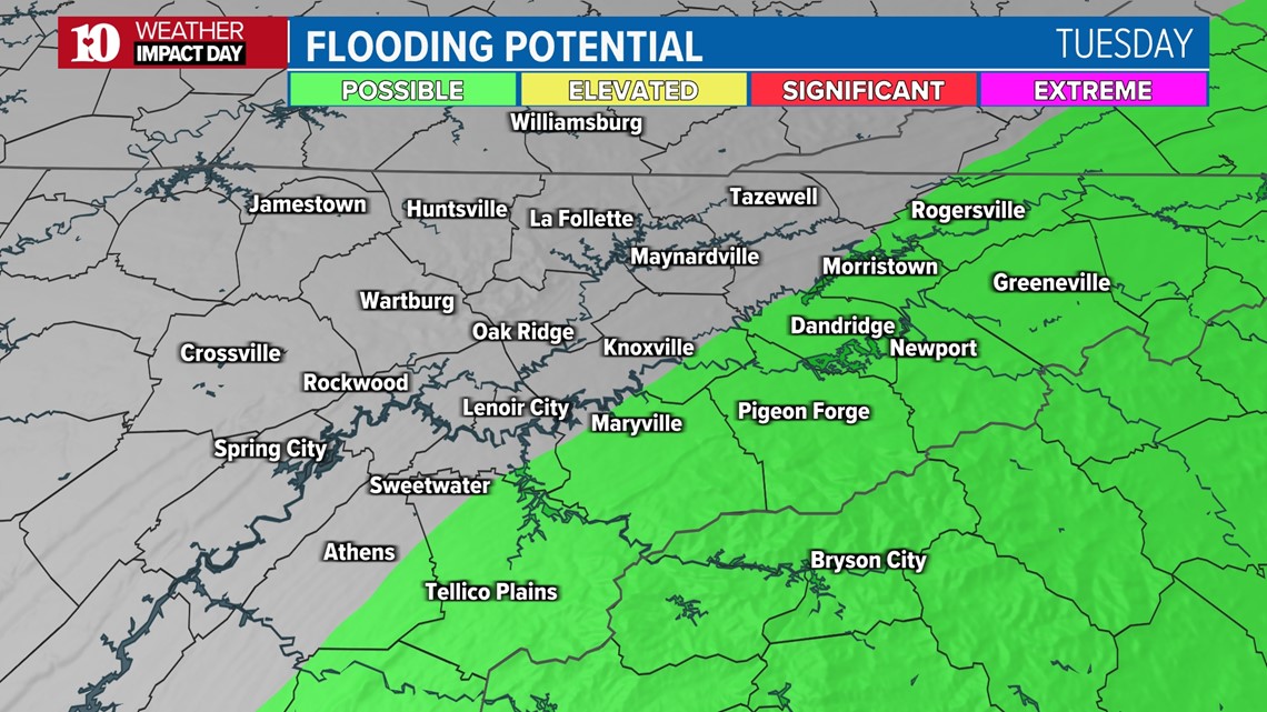
If the rain is heavy enough, flash flooding may become an issue near burn scars. After such a long period of dry weather and during current drought conditions, the soil can become "hydrophobic" in some locations, meaning that the water will run off instead of being absorbed into the ground.
So to recap, strong winds could cause downed trees and power lines, as well as create extremely dangerous fire conditions through the rest of the day today, overnight and through the first half of the day Tuesday.
Please check back for updates and stay safe!