KNOXVILLE, Tenn —
WIND
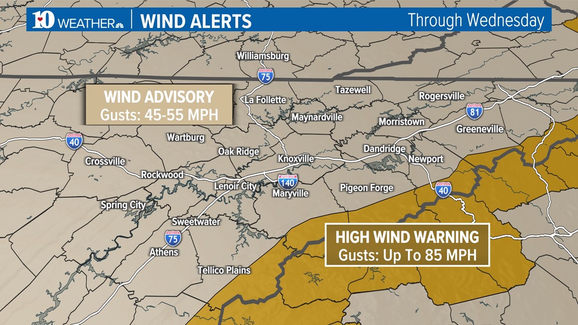
A tightening pressure gradient will cause winds to increase tonight and the National Weather Service has issued a High Wind Warning for the Mountains for gusts up to 85 mph. It wouldn't be a surprise if the highest peaks, like Cove Mountain, reach 100 mph!
A Wind Advisory has been issued for the areas shaded in tan where winds could gust up to 50-55 mph in parts of the Valley and on the Plateau, where a few downed trees and isolated power outages are possible.
Breezy conditions will last through the evening and gusty winds may linger in the Valley into Wednesday... Secure loose objects on your property!

RAIN
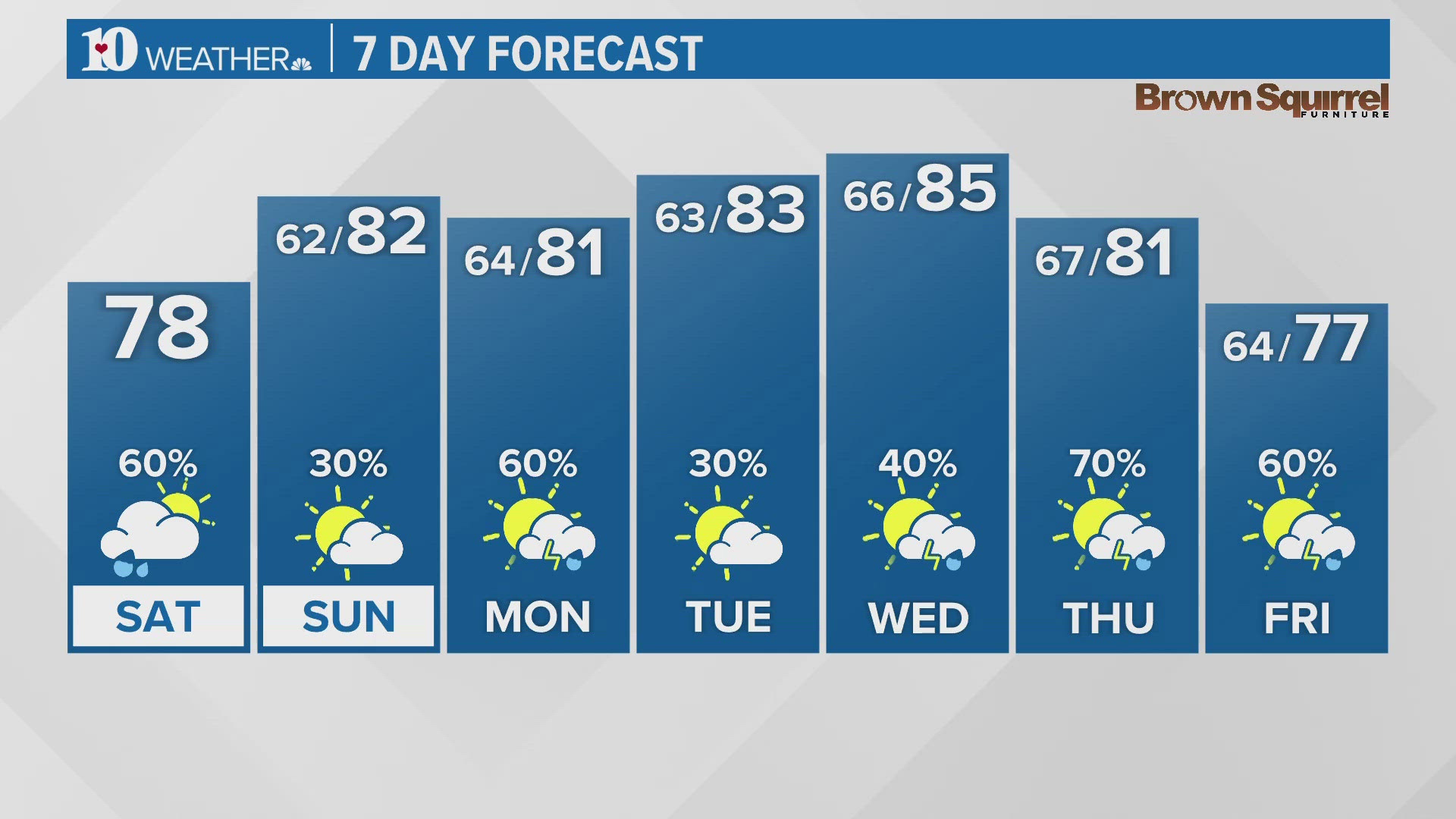
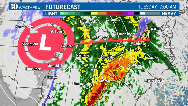
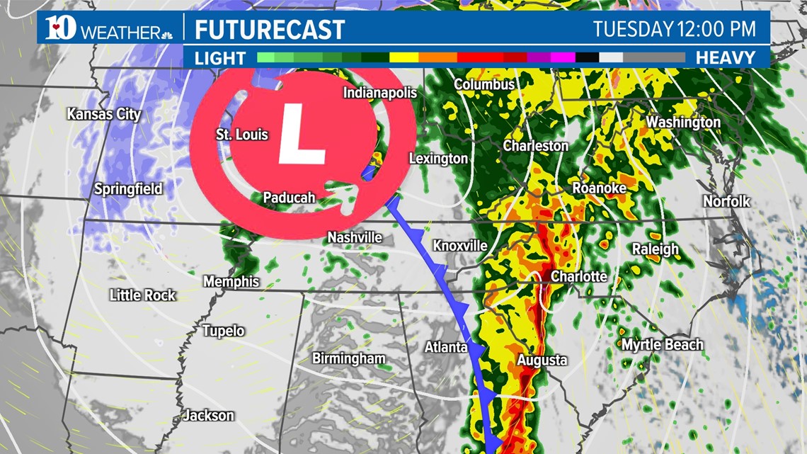
Heavy rain arrives overnight tonight and lasts through the first half of the day Tuesday.
A few rumbles of thunder are possible but no severe weather is expected for our area. (NOTE: Winds will already be strong due to the tight pressure gradient.)
Rain chances become more scattered in nature by Tuesday evening but wrap-around moisture will keep light showers, and eventually flurries, in the forecast into Wednesday morning.

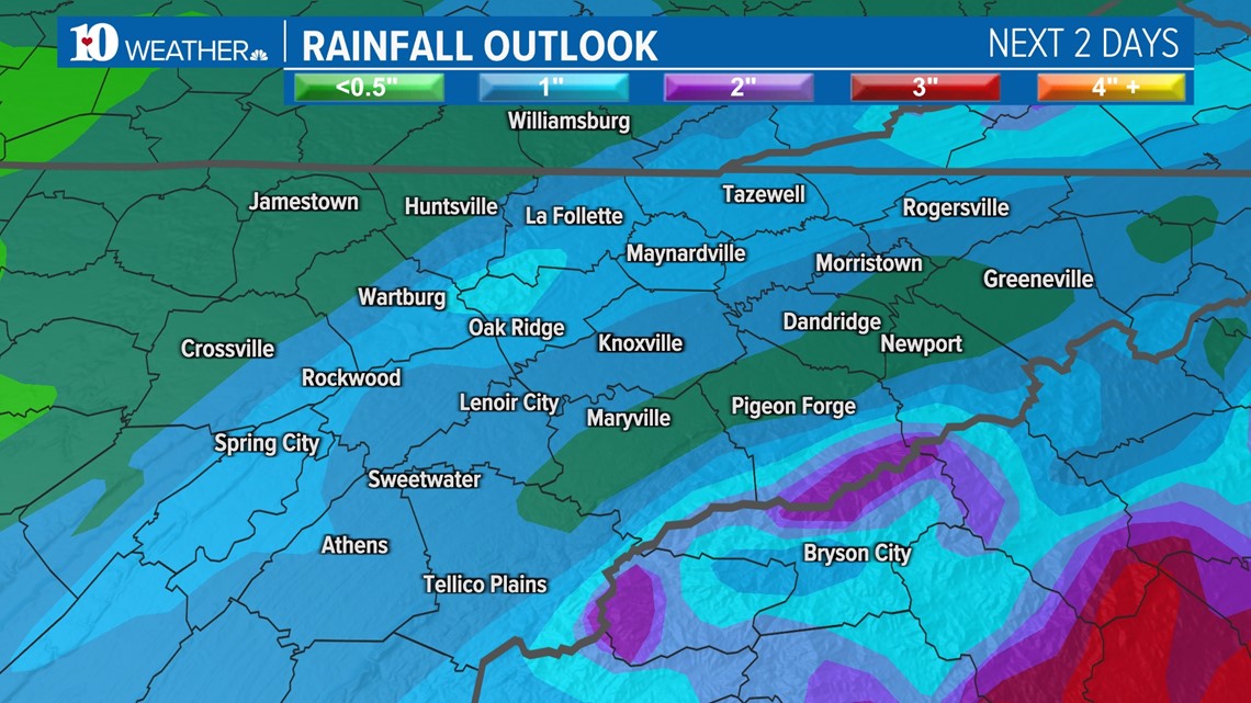
Down-sloping winds will keep totals lower in our northeastern counties but most locations could see at least 1" of rainfall.
Parts of the Central and Southern Valley and Plateau may have totals closer to 2", with higher totals possible.
While localized flooding is possible, this shouldn't be a widespread issue due to our current drought conditions and how quickly the system will move through the region.

SNOW
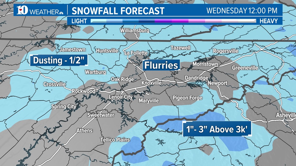
Wrap-around moisture and colder air moving into the region mean that lingering light rain showers will change to light snow showers overnight Tuesday night into Wednesday morning.
A dusting to 1/2" of snow is possible on the Plateau, in Southeast Kentucky and in the Northern Valley, while a couple of inches of snow may accumulate in the higher elevations of the Mountains.
The Central Valley may see some flurries but no accumulations are expected.

RELATED: Winter driving safety: 5 Fast Facts
We'll have a brief break from the active weather on Thursday, then another strong system moves into the Southeast Friday.... Check back for updates!