KNOXVILLE, Tenn. — RELATED: Winter storm with snow, ice, wind and bitter cold pummels much of the northern US
Tuesday and Wednesday will be 10Weather Impact days as very cold air moves into our region, as well as continued hazardous roads due to heavy snow on Monday.
Roads have become snow-covered and icy—which will greatly impact commutes as temperatures stay below freezing. The best advice is to stay off the roads, and let TDOT crews treat the main highways and routes. School is already closed again today and tomorrow in many areas.
In addition, temperatures will drop aggressively this week.

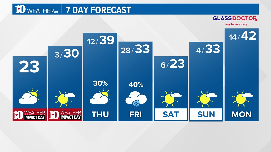
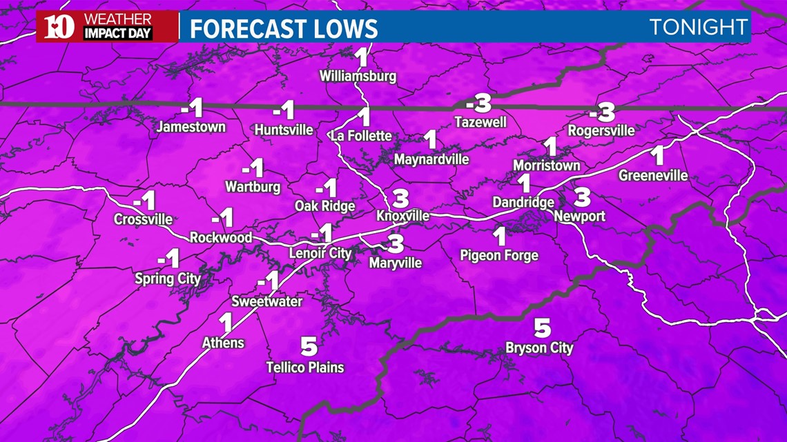
Both Tuesday and Wednesday will be below-freezing all day long. The persistent cold will allow the snow and ice to stick around longer. Low temperatures Wednesday morning are forecast to be frigid from -5° to 5°, with even lower wind chills dangerously cold below zero.


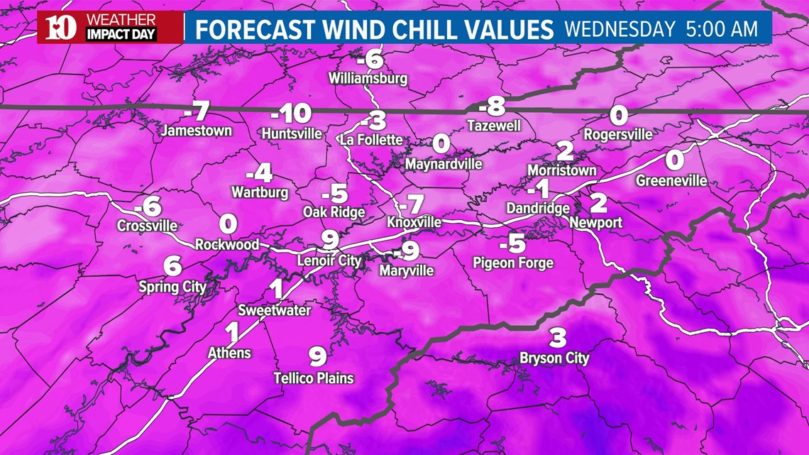
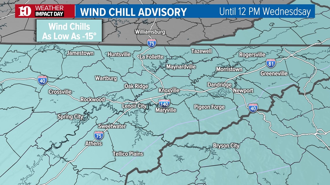
**A Wind Chill Advisory is in effect until Noon Wednesday. Wind chill values between -5° to -15° are expected along the Plateau, stay warm!!**

Thankfully, temperatures briefly recover into Thursday as we get just above freezing, but more wintry weather is possible to end the week. More updates will come as we get closer.