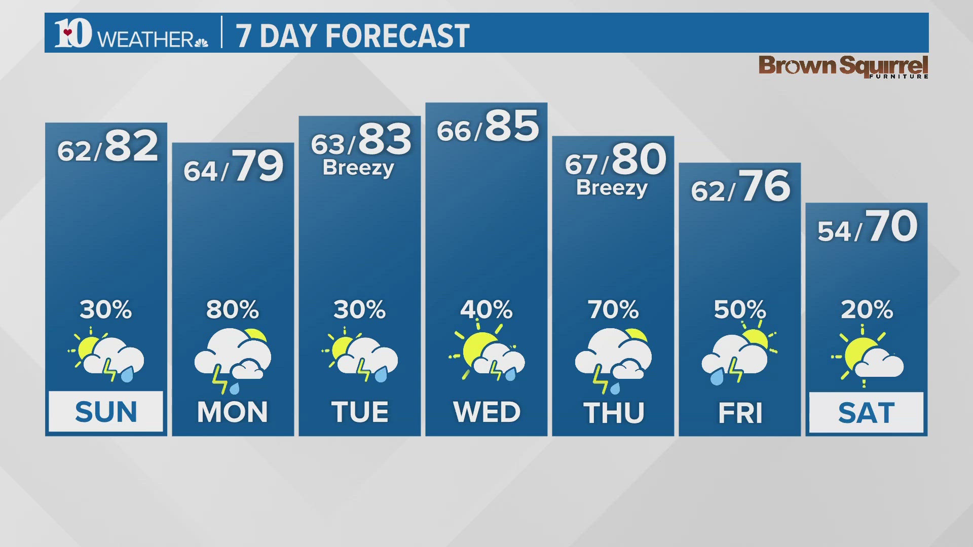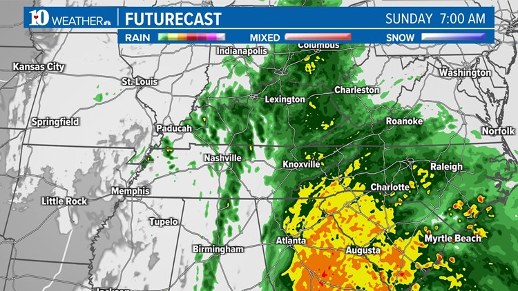
KNOXVILLE, Tenn — A low-pressure system from the west will drag a cold front and rainfall through East Tennessee on your Sunday morning. Meanwhile, another powerful low-pressure system will move from the Gulf of Mexico to the Atlantic Coast, bringing heavy rains, inland & coastal flooding, and possibly severe weather to those areas. We're watching that system as well to see if any of that rainfall will make it into East Tennessee.
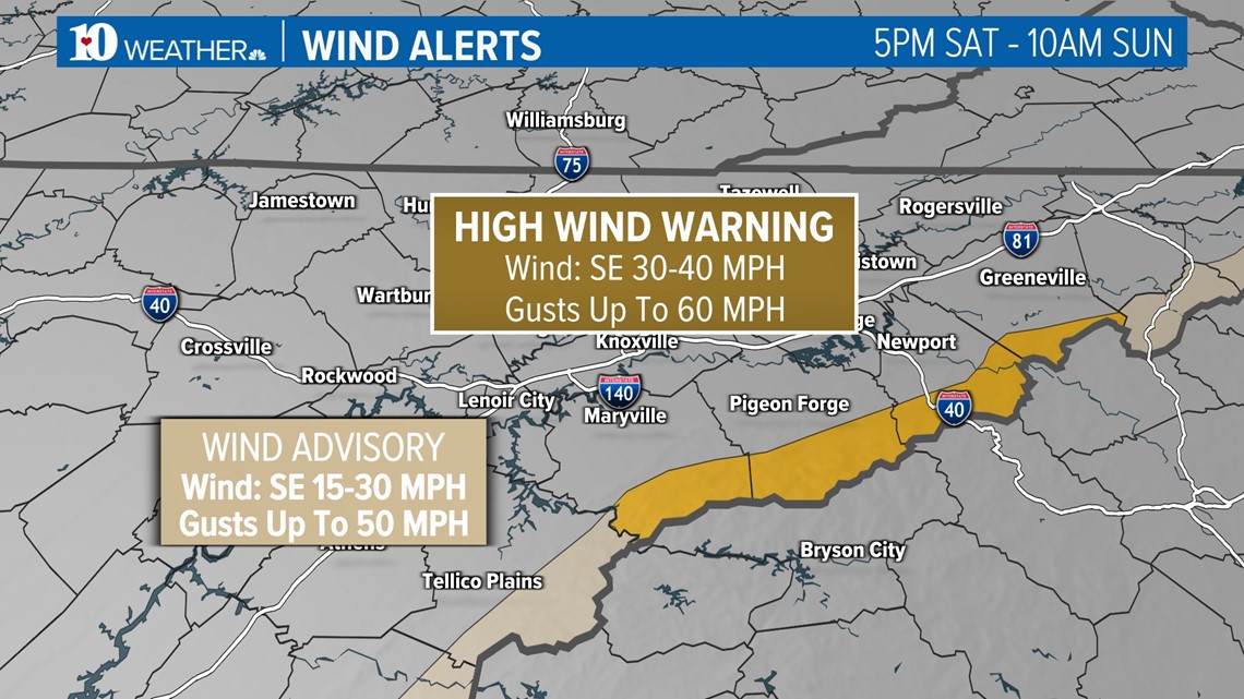
Before the rain arrives, strong winds are expected in the Mountains. The former High Wind Watch has been upgraded to a Warning for the higher elevations of the Smokies from late Saturday afternoon through late Sunday morning where gusts could gust as high as 60 mph. Elsewhere in the Mountains, a Wind Advisory was called for gusts up to 50 mph.

As we cross the midnight hour from Saturday into Sunday, we'll start to see spotty showers moving in from the West and the South. Over the following morning hours, the rain will take over East Tennessee. You'll likely wake up to it on your Sunday morning, so be careful on the roads if you head out.

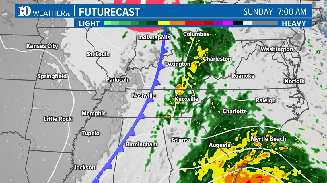
As we cross the midnight hour from Saturday into Sunday, we'll start to see spotty showers moving in from the West and the South. Over the following morning hours, the rain will take over East Tennessee. You'll likely wake up to it on your Sunday morning, so be careful on the roads if you head out the door. Scattered showers may linger through part of the afternoon so keep the umbrellas handy.
RAIN

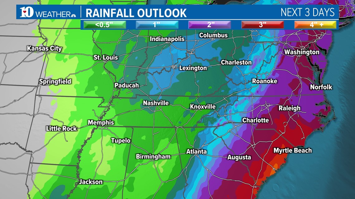
Models recently have pushed the more aggressive low-pressure system farther east along the Atlantic coastline, so our rainfall totals here in East Tennessee have dropped significantly. We're now expecting about 0.5"-1" area-wide. Higher totals near 1.5" will be in the mountains, while those in the Plateau may only see 0.25" of rain, primarily coming from the passing front.
Any chances of snow early next week look to mostly be in the higher elevations through we could see a few flurries in the northern Valley if the cold air arrives before the moisture departs.

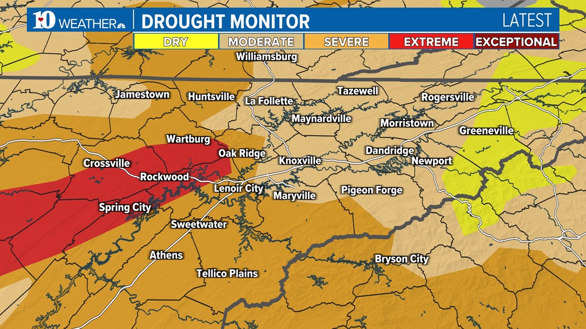
We'll take every bit of rainfall that we can get because we're still seeing drought conditions. Thankfully, they've been improving all month long! This most recent update, released December 14th, shows Level 1 conditions in parts of Northeast Tennessee. But it's the Southern Valley and Plateau that needs the rain the most. We may just have to wait for the next rain event.