KNOXVILLE, Tenn. — ***Flash Flood Warning from 5/27/2024 5:19 a.m. to 9:30 a.m. EDT for Sevier County, TN**
We are in the heart of severe weather season here in East Tennessee and for the unofficial start to summer this weekend, scattered storms could impact your outdoor plans.
An active pattern continues to bring waves of storms each day and so far, damaging winds and hail have been the main threats.
Storms so far this weekend have been short-lived, but there is a more intense, severe turn as we look to Sunday.
Sunday morning, a cluster of storms is moving east through Kentucky and the northern half of Tennessee. Models hadn't picked up on the intensity at first, but now we see plenty of strong to severe storms that will push into the area starting early Sunday afternoon. This is in addition to a nighttime round of severe storms that meteorologists were already looking toward.
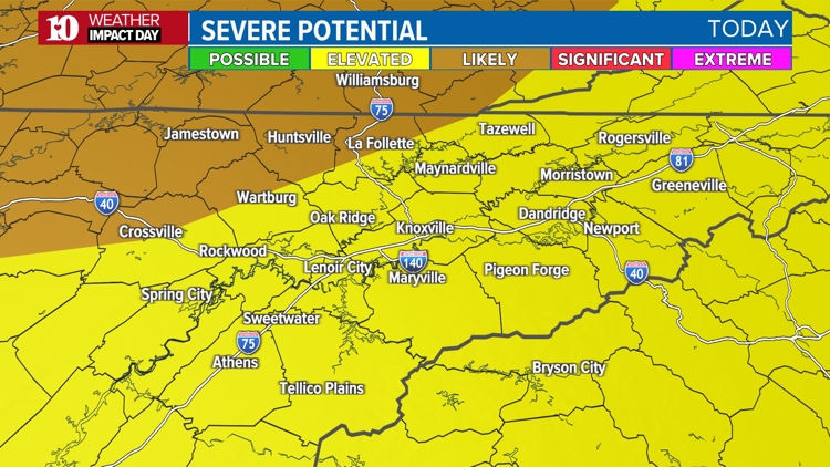
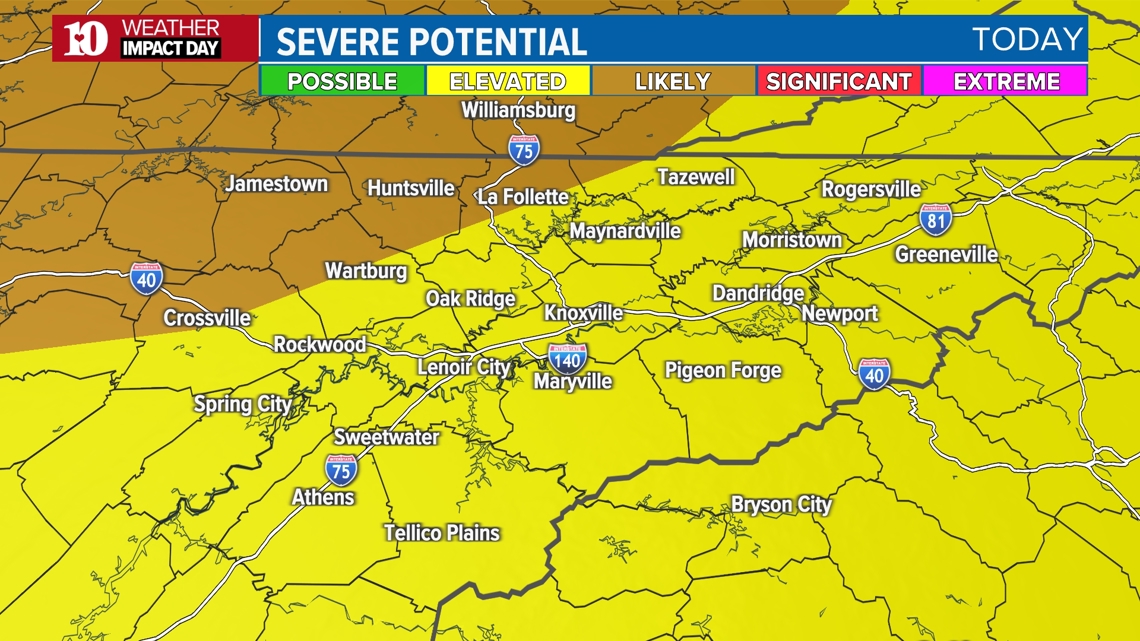
SPC has already highlighted East Tennessee for this potential. We have our strongest, Level 3 risk in the NW Plateau, and everywhere else is under a Level 2 threat.

This includes 70+ mph wind gusts, hail up to 1", heavy downpours that may lead to flooding, and we cannot rule out the isolated tornado.

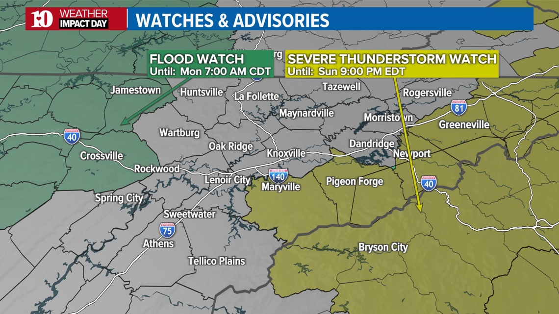
The tornado threat is something that has grown larger for this Sunday-Monday time period compared to previous days. As of right now, it appears that the first round could use up a good amount of energy in the atmosphere, leaving less for the overnight round. Regardless, keep your alerts active for both events.

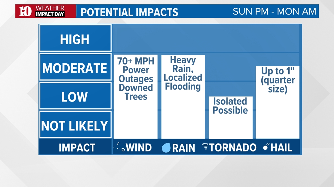
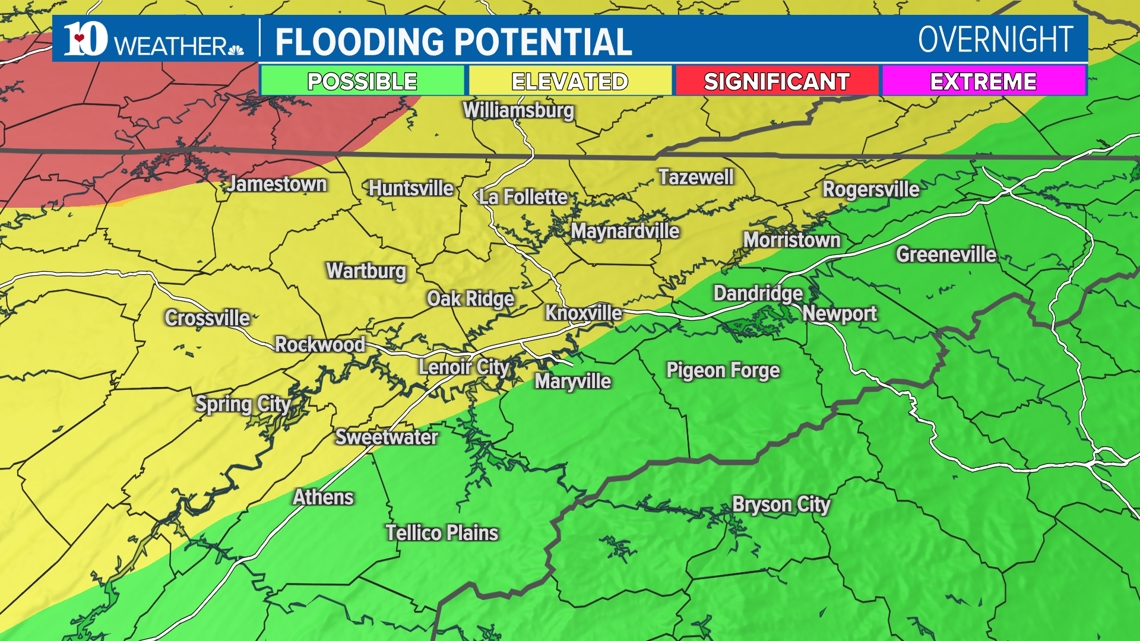
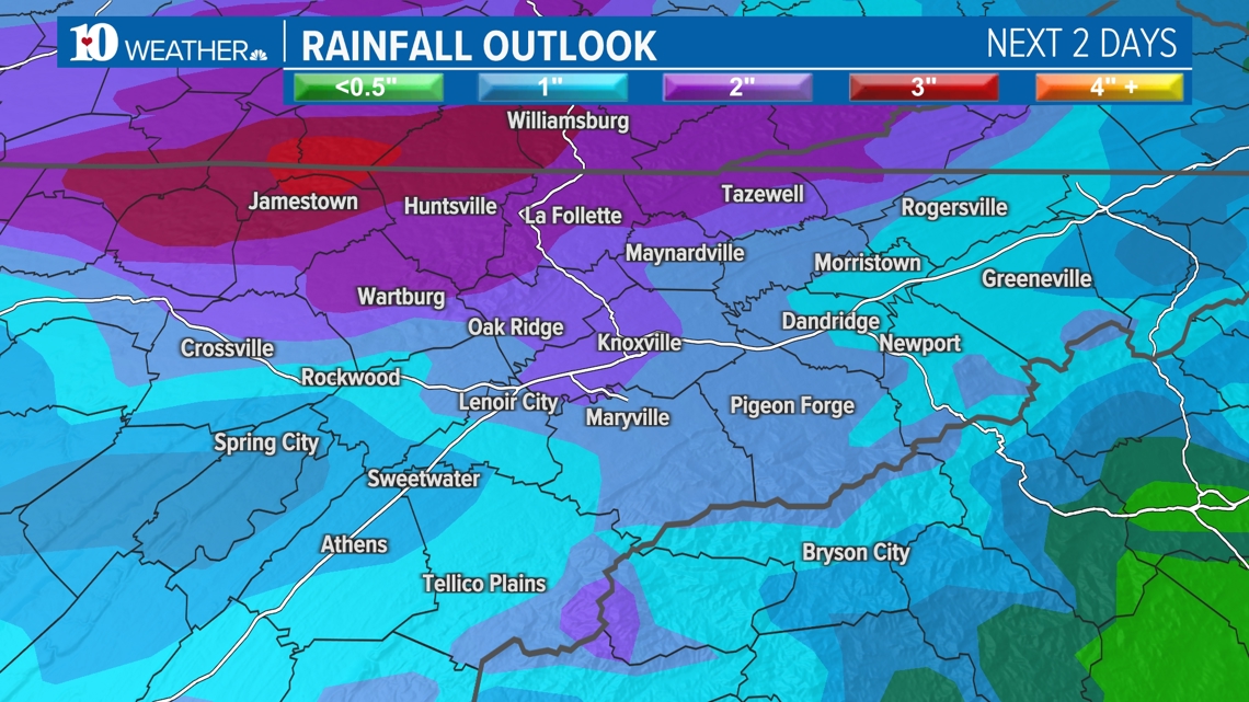
Flooding will also be a growing concern through the next few days. Rainfall could reach 1-2"+ between both events. We're up to a Level 2 risk of flooding, since this rainfall will come on top of all that we've already received this month.
Heavy rain could cause rivers, creeks and streams to rise so pay attention to water levels if you'll be spending time near those locations.


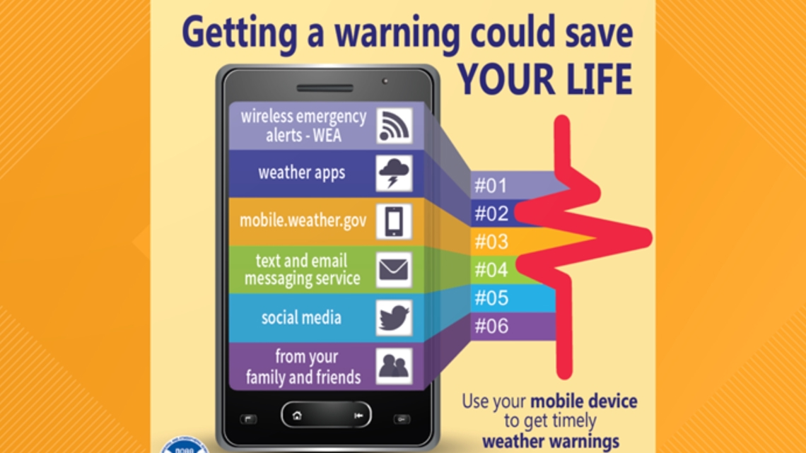
Make sure you have multiple ways to receive alerts and remember, when thunder roars, head indoors!