
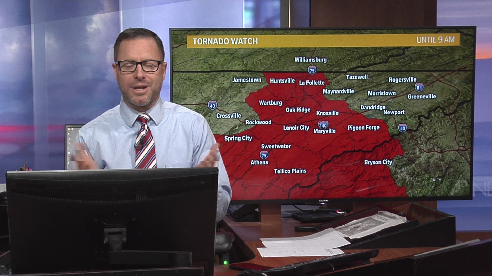
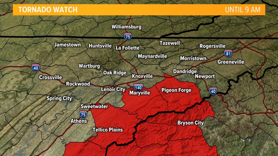
East Tennessee — **A Tornado Watch is in effect for parts of East Tennessee until 9 AM EST. This means that you should be PREPARED to take action. If a WARNING is issued move to the lowest level of a sturdy building away from doors and windows until the storm passes.**
The National Weather Service has continued a Tornado Watch for Blount, Monroe and Sevier counties until 9 a.m. Tuesday but canceled a Tornado Watch for Anderson, Knox, Loudon & McMinn counties.
►Download our free WBIR weather app (Apple, Google Play) with interactive radar and follow us on social media for the latest updates through the night.

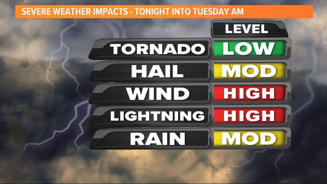
IMPACTS: Damaging wind, hail and isolated tornadoes will be possible. Heavy rain may also cause localized flooding.

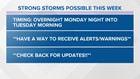
So what can you do to prepare? Understand that the storms may move through while you are sleeping Monday night... DO NOT GO TO BED WITHOUT HAVING A WAY TO RECEIVE ALERTS AND WARNINGS!
You can download the FREE WBIR Weather App, go under the settings and have alerts sent to your phone when a watch or warning is issued for your location. Yes, you need to receive both severe thunderstorm and tornado warnings.
Make sure that your Emergency Alerts are turned on under the notification settings on your cell phone.
Another option is to leave your TV on so that if a warning is issued, (hopefully) the emergency alert sound will wake you up.
Having a NOAA Weather Radio is also a great way to make sure you are aware of what is happening with the weather.
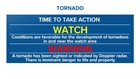
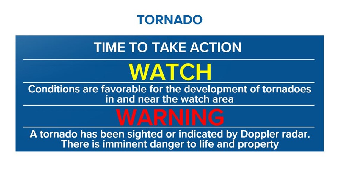
It is also important to know the difference between a WATCH vs a WARNING.
A WATCH means that conditions are favorable for the development of severe weather. This means that you should be alert to changing weather conditions and be prepared to take action if necessary.
A WARNING means that severe weather is imminent or occurring. This means that you need to take action and move to to a safe place. Move to the lowest level of a sturdy building away from doors and windows until the storm passes.
The good news is that the potential for severe weather should end by the late morning hours on Tuesday with rain chances gradually ending and slowly clearing skies for the rest of the day.
If you still need to vote, we would recommend heading to the polls during the late morning, afternoon or evening so you can avoid getting caught in the rain or storms... But still go out and cast your ballot!
We will continue to refine the details of this forecast so check back for updates!**