KNOXVILLE, Tenn. — Strong storms rolled into East Tennessee on Thursday, bringing trees down across the region.
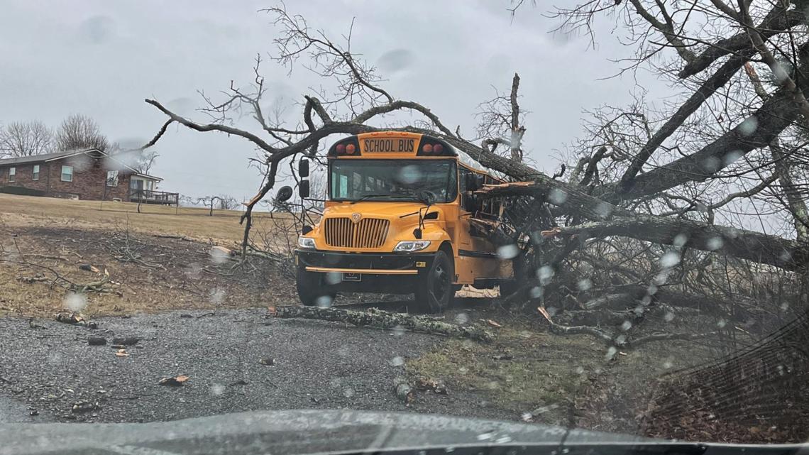
One of them landed on a Sevier County school bus that was parked near a school, heavily damaging it.
No injuries were reported and the school district said they were using another bus to take children home. They said the route home could take longer than usual Thursday afternoon due to the number of downed trees.

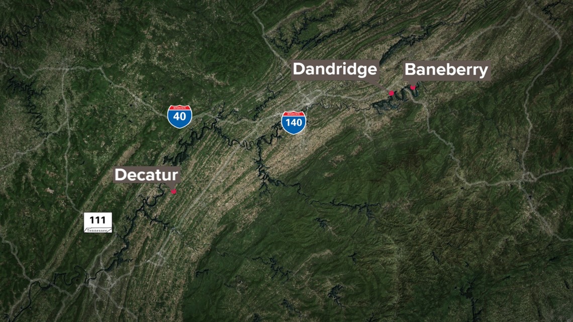
According to NWS Morristown, an EF-0 Tornado, with estimated winds of 80 mph landed in Jefferson County. It had a length of about 1 mile and a width of about 100 yards near the Baneberry area. The tornado occurred between 1:26 p.m. and 1:28 p.m. on Thursday.
Later on Friday, they said they found another small EF-0 Tornado path that passed through Jefferson County. They said its maximum estimated winds were around 70 mph and its path was around 0.23 miles long, and around 30 yards wide. They said it was southwest of Dandridge and touched down at around 1:14 p.m. on Thursday.
The NWS also said there was an EF-0 Tornado near Decatur, in Meigs County. They said it was estimated to reach 75 mph and its path was around 0.57 miles long, and around 150 yards wide. They also said a person was injured in that tornado.
Other counties were briefly placed under a tornado warning as a result of the storm. Those counties were Greene, Hamblen and Cocke counties and it expired at 1:45 p.m.
Powerful winds gusted above 60 mph toppling trees along roads such as Alcoa Highway and U.S. 25E in Jefferson County. Some roads had to be closed so crews could remove tree limbs and debris.
Several thousands of power outages were also reported as the storms moved through the area. You can check on power outages in your area here.
Tornado watches in the region were canceled as of 3:30 p.m., but the threat of damaging winds and strong storms persisted later Thursday night. A line of colder air will also arrive, bringing the potential for some flurries in the lower elevations and snow in the mountains.