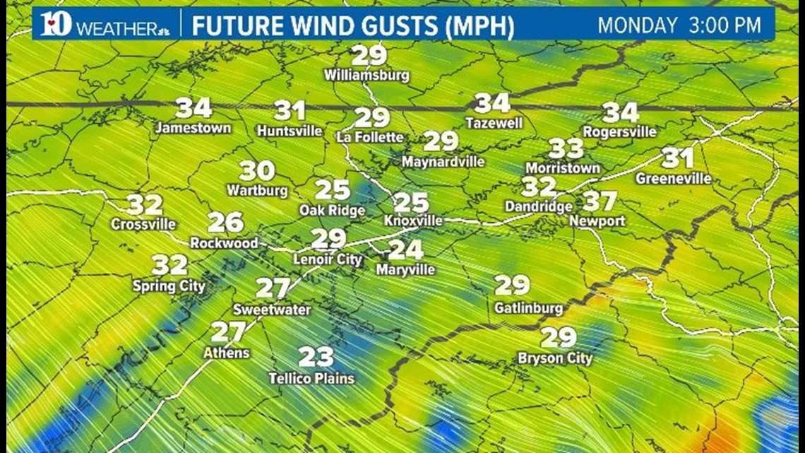
KNOXVILLE, Tenn. — A cold front is forecast to move into the area Monday that will bring in much colder air and blustery conditions.
Highs on Monday will be in the 40s with wind chill factors in the 30s. Winds will be breezy out of the northwest with gusts up to 25 mph.

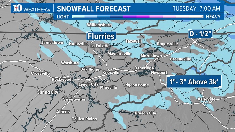
Some areas could see the chance for a wintry mix depending on the timing of the cold air and how much moisture is in place starting Monday evening.
1"-3" of snow will be possible for areas above 3,000 feet. Keep in mind, all the ingredients need to come together for snow to happen. It does look like the higher elevations will have the best chance for accumulation.

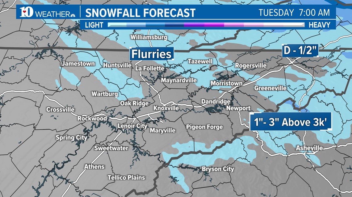
For the rest of us, we might see a few flurries if conditions are right. The light precipitation shouldn't accumulate or impact roads.
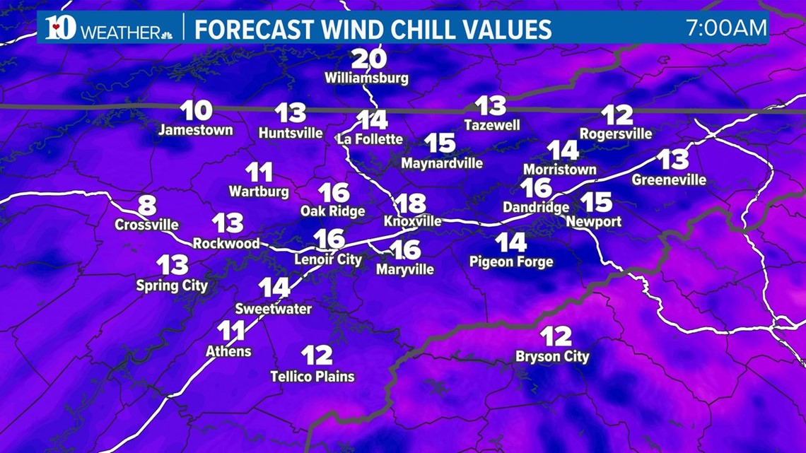
Regardless, it's going to be bitterly cold. Wake-up temps will be in the 20s and it will feel like it's in the teens and single digits in some places with the wind chill.

Sunshine will return Tuesday although highs will be almost 15 degrees below average in spots. A slow warming trend will return by the end of the week.
Winter starts on Thursday at 10:27 p.m.