
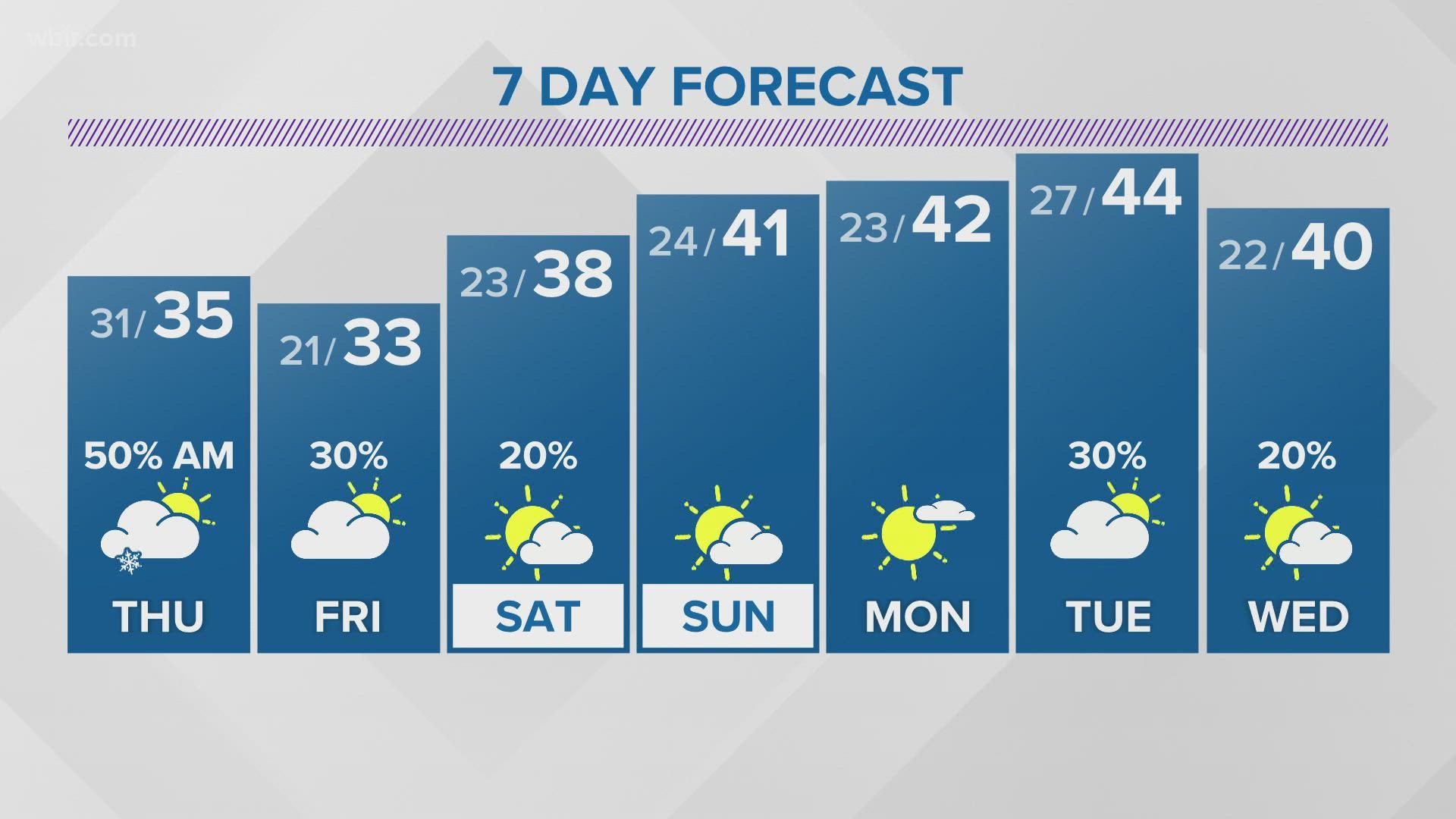
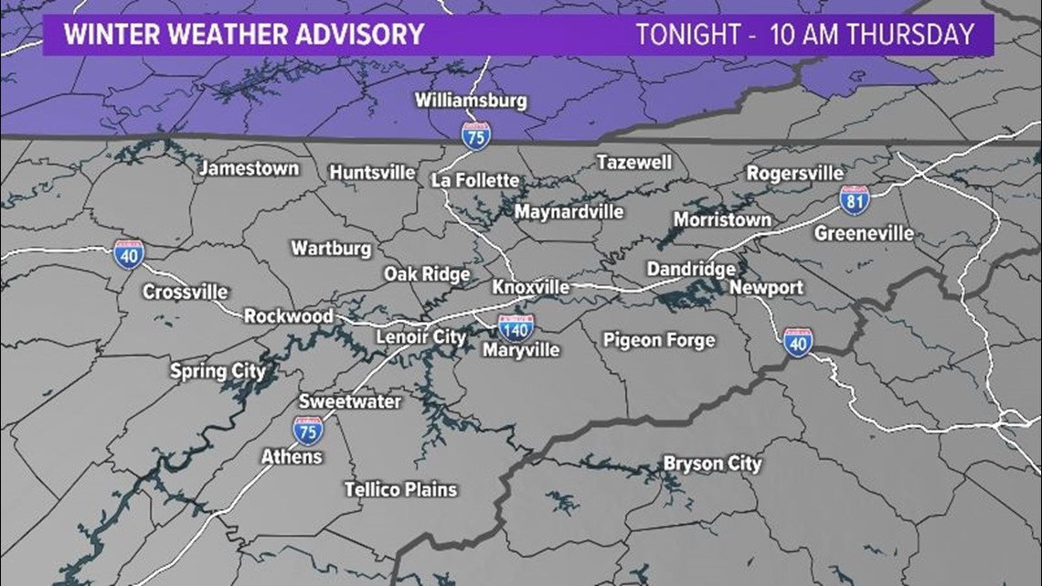
KNOXVILLE, Tenn. — Say it ain't snow, we have another chance for some wintry weather tonight into Thursday morning.
Scattered rain showers will develop along a cold front late this evening and overnight tonight.
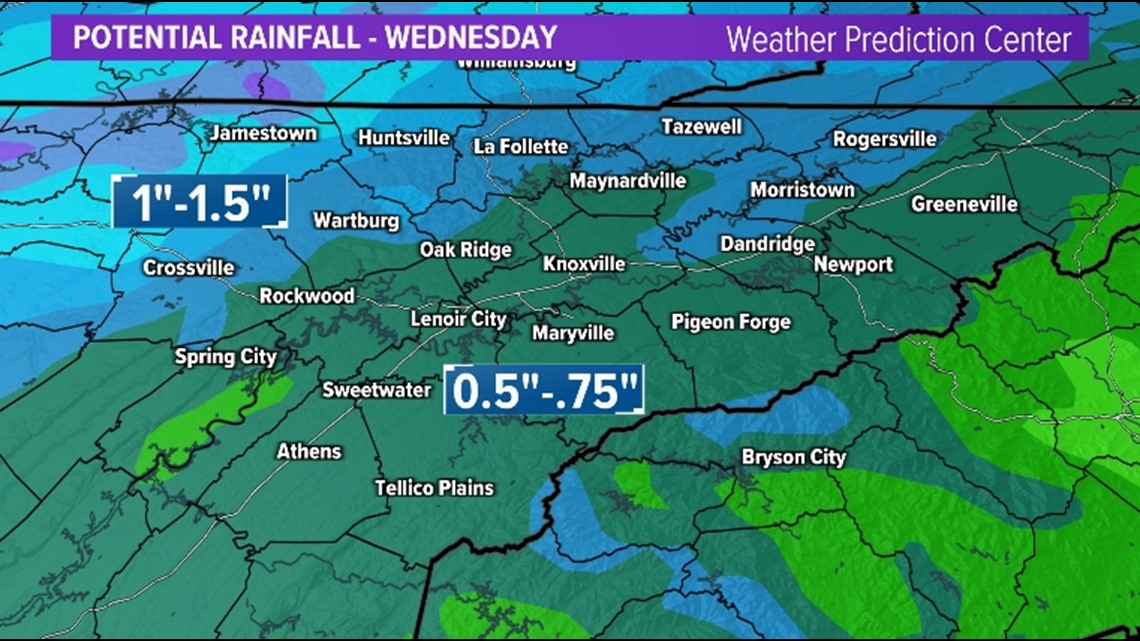
Rain could be locally heavy at times in some areas and with melting snow and cold ground, some minor flooding is possible on the Plateau.
Rainfall totals will generally be around 1" on the Plateau and closer to 0.5" in the Valley.

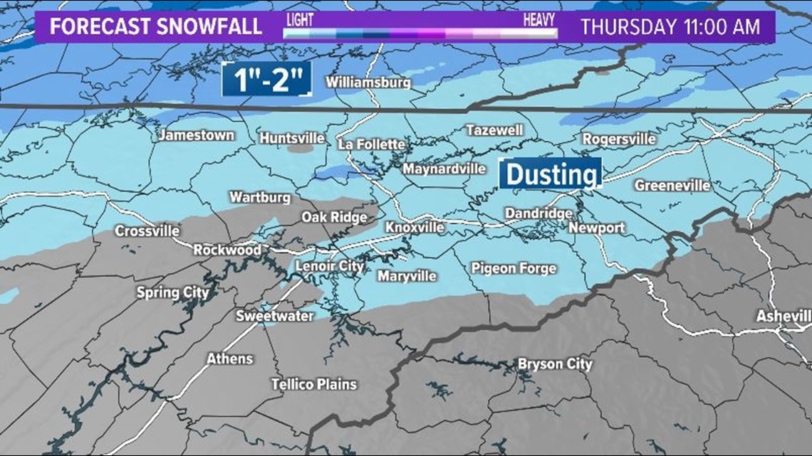
Colder air will begin to move into the region behind the front and rain will change to snow after midnight on the Plateau and just before sunrise in the Valley.
The big question is: Will the cold air arrive into the Valley before the moisture moves out? It appears it will, but only for a brief period of time, so impacts will be limited to mainly elevated surfaces
So don't take the lines on this graphic too literally as we could see some changes depending on the timing of the cold air/moisture.


Once this front passes, Arctic air will be in place for Thursday and Friday... Which is when another weather system will be passing by just to our south and east. But some of this moisture may try to move back into our eastern areas later Friday into Friday night.
We will have more information as we get closer to this event.
Please check back for updates!