
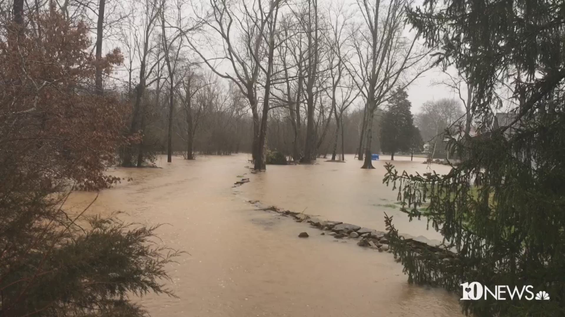
Parts of East Tennessee are seeing flooding after rain overnight and a rainy week.
Authorities across the area are closing roads and responding to flooding calls.
The Knoxville Police Department said 98 roads were closed because of flooding.
RELATED: Rockslide closes I-40 between TN/NC state line and Asheville, traffic being diverted to I-26
These aren't all of them, but Knoxville Police tweeted out the following road closures:
- Chapman Highway at Dick Ford Lane
- Broadway at Walker Boulevard
- Walker Blvd at Whittle Springs
- Ault Road at Shangri-La Drive
- Hollywood Road at Kelly Place
- Carnation Drive at Clifton Road
- McKamey Road at Matlock Drive
- Hollywood Road at Sutherland Avenue
- Sutherland Avenue at Papermill Road
- Cedar Bluff Road at Dutchtown Road
- Mineral Springs Avenue at Walker Boulevard
- Mildred Drive at Woodhaven Drive
- Concord Street at railroad tracks
- Hembolt Road at Creekhead Drive
- Black Oak Drive at Oak Road
- Hall of Fame Drive at Sixth Avenue
- Broadway at McCroskey Avenue
- Beverly Road at Oakland Drive
- Sutherland Avenue at Concord Street
- Kingston Pike at Downtown West Boulevard
- Third Creek Road at Middlebrook Pike
- Cross Park Drive at Bridgewater Road
- Capitol Drive at Kingston Pike
- Middlebrook Pike at Dowell Springs Boulevard
- Dutch Valley Drive at Old Broadway
- Central at Corum
- Tenwood Drive at Knott Avenue
- Tazewell Pike at Fountain Gate Road
- Chapman Highway at Stone Road
- Woodrow Drive at Broadway
- Sutherland Avenue at Cox Street
- Wrights Ferry Road at South Northshore Drive
- Kingston Pike at Cedar Bluff Road
- Kingston Pike at North Peters Road
- Kingston Pike at Ebenezer Drive
- Cedar Bluff at Parkwest Drive
- Western Avenue at Sanderson Avenue
- 6th Ave at Glenwood Avenue
- Bernard Avenue at railroad tracks
- Loves Creek Road at Rutledge Pike
- Cedar Lane at Knox Road
- Chilhowee Drive in front of Holston Middle School
- Callahan Drive at Central
TDOT reported issues on the following roads:
- Right lane of State Route 9 at Clinton Highway is blocked because of a possible slide.
- State Route 335 Proffitt Springs Road (5.29 MM) - ponding
- State Route 33 at Highway 129 (10.38 MM) - ponding
- State Route 35 at 129 to Blount-Sevier County line (0- 15.78 MM) - ponding
- State Route 73 at W. Millers Cove Road to Long Branch Road (22.65-25.94) - one-lane traffic due to slide
- State Route 115 at Indian Warpath Rd (4.77 MM) closed due to flooding
- State Route 297 in Campbell County (Newcomb area) - high water but no lane closures.
- Interstate 75 in Campbell is being monitored by crews as an area of concern was identified north of the exit
- State Route 1 between Spring Hollow Road – Parrott Lane (8.05 – 9.63MM) closed due to flooding
- State Route 340 between Neil and Turner (5.04 – 7.65) - one-lane traffic due to slide
- State Route 348 closed at LM 1.0 and 10.5 due to high water
- State Route 344 at Needmore Road (3.8 MM) closed due to flooding
- State Route 34 at Russelville Elementary School (13.72 MM) closed due to flooding
- State Route 113 at Melinda Ferry Road (3.78 MM) closed due to flooding
- State Route 70 Cave Springs Road to Clinch Valley Rd (15.1 -18.3MM) closed due to slide
- State Route 66 New Life Road to Clinch Valley Road (23.32 – 26.25) closed at LM 24 due to slide
- State Route 139 Westford Rd to Workman Road (1.7 to 4.4 MM) closed due to flooding
- State Route 139 Blue Springs Road (1.09 MM) closed due to flooding
- State Route 363 closed due to cracking in roadway (LM 2-2.5)
- State Route 92 closed due to slide and will remain closed until weather subsides and site is stable
- State Route 131 at I-75 ramp from Emory road to 75 southbound closed due to flooding
- State Route 62 at Hackworth Road (3.53 MM) Closed due to mud slide (this has changed from flooded road to mud slide)
- State Route 332 between Northshore and Keller Bend (1.95 – 7.04 MM) flooded roads travel not recommended, possible closure
- State Route 168 at Neubert Springs Rd (4.83 MM) flooded travel not recommended
- State Route 2 at Pike St (13.01) closed due to flooding
- State Route 2 at Davis Drive (17.09 MM) closed due to flooding
- State Route 35 at Blowing Cave Road (26.79MM) - travel not recommend
- State Route 338 from Terry Road to Lindsay Road (12.56 – 14 MM) - closed due to flooding
- State Route 338 at Shell Mountain Rd – N Ball Hollow Road (7.12 – 7.91) Road closed due to flooding
- State Route 35 at Tarwater road (11.54 MM) road closed due to flooding
- State Route 416 reduced to 1 lane of travel
- State Route 73 (Gatlinburg) near Rattlesnake Hollow Road, lane closure
Anderson County, Jefferson County and Monroe County dispatchers reported road closures across the county.
Knox County and Roane County dispatch said the list of roads affected by flooding is too long to name.
An Anderson County dispatcher said Lake City Highway is flooded just outside of Clinton at the intersection of Pumphouse Lane. TDOT said the right lane of State Route 9 at Clinton Highway is blocked because of a possible slide.
The Blount County Sheriff's Office reported flooding on these roads:
- East Lamar Alexander Parkway
- Sevierville Road at Keeble Road
- River Ford Road at Pea Ridge Road
- Park Drive at East Lincoln
- Cloyds Church Road at Marble Hill Road
- Cross Creek Drive at Helmsley Drive
- John Helton Road
- Gateway Road
- Binfield Road at Railroad Bridge
- Ellejoy at Temple
- Tabernacle Church to Old Niles Ferry
- U.S. Highway 411 South at Binfield
Cumberland County dispatch reported flooding on Highway 68 at the south end of Grassy Cove.
Grainger County dispatch reported these roads as closed:
- Emory Road and McKinney Road
- Willis at County Line Road
- Knob Road between Lester Whitt Road and Cooper Road
- Lower ends of Lee Lake Road
- Clinch Valley Drive
Hamblen County dispatch reported flooding at these locations:
- Spencer Hill at Long Creek Road
- Buell Chapel Road
- Clyde Thomas Road
- Robinson Creek at Robins Circle
- Old Russellville Pike
The Sevier County Sheriff's Office posted these road closures because of flooding on Facebook:
Academy Dr/Chilhowee School FLOODED
Apline/Lin Creek Road Collapse
Apple Valley @ Lomesome Valley CLOSED
Birds Creek/Glades Road FLOODED
Blowing Cave/Alpine FLOODED
Bryan/Brookeside Lane CLOSED
Boogertown Road FLOODED
Boyds Creek Church FLOODED
Boyds Creek Hwy (Multiple Areas) FLOODED
Boyds Creek/North Pitner FLOODED
Burden Hill-CLOSED CLOSED
Chapman Hwy @ Old Sev Pike down OPEN Chapman Hwy/Pleasant Hill OPEN Chapman Hwy/Pleasant View OPEN Chapman Hwy/Tarwater Stretch Eastbound OPEN
Chapman Hwy @ Ye Ole Steak OPEN Cherokee Hills/411 FLOODED
Cherokee Valley 3105 CLOSED
Chilhowee School/Emerts View FLOODED
Country Oaks Drive FLOODED Cove Creek/Wears Valley FLOODED
Creekside Plantation FLOODED Crossover Road FLOODED
Dixon Branch FLOODED
Dixon Branch @ Jones Cove FLOODED
Douglas Dam Road (338)/Kentwood CLOSED
Douglas Dam Rd-3559 CLOSED
Douglas Dam Road/Dawson Way CLOSED
Road Way Brok Off Douglas Dam Road 320 Kodak- CLOSED OPEN
Douglas Dam Road 3650-Kodak FLOODED
Dripping Springs Road Road Collapse
Dupont Road 1520-CLOSED CLOSED
Dupont Road/S. Delozier Road FLOODED
Swiftwater E Dumplin @ Bryan Road CLOSED East Gate at Broad FLOODED
East Gate/Cash Hardware CLOSED
East Gate/Henderson CLOSED
East Gate/ Trula Lawson CLOSED
E Macon/Chapman Hwy CLOSED
East Ridge/Veterans Blvd OPEN
Ernest McMahan/Belle Meadows FLOODED
- Old Knoxville at Oak Haven
- New Era at Seagle Landscaping
- New Era at Apple Valley
- 140 Block of White School Road
- White School at Dynamite
- 1500 Block of Dupont Road
- Greenbriar at GSMNP
- 900 Block of White School Road
- Mill Creek at Rush Branch
- Wears Valley Rd at Valley View
- River Divide at West New Era
- Ridge Road at Compost Center
- Dupont Road at South Delozie
- Russie Gap at Waldens Creek
- Goose Gap at Waldens Creek
- Old Newport at Heritage Propane
- Old Newport at Hattie Creek
- Old Newport at Fairgarden
The following areas are dealing with a mudslide or a rockslide, according to the Sevier County Sheriff's Office:
- 1300 Block of Upper Middle Creek Road
- Mill Creek Road at Rush Branch
- 4500 Block of Wilderness Plateau
Union County dispatch reported Highway 61 East at Jim Town Road is closed because of flooding.