KNOXVILLE, Tenn. — We've had a very active weather pattern so far this January and the parade of storms isn't slowing down just yet.
Another strong area of low pressure will develop and move through the Southeast today and just like the last one on Tuesday, wind is going to be our biggest concern.
A tight pressure gradient will crank up wind gusts early this morning, starting in the mountains and on the plateau, then spreading into the valley.
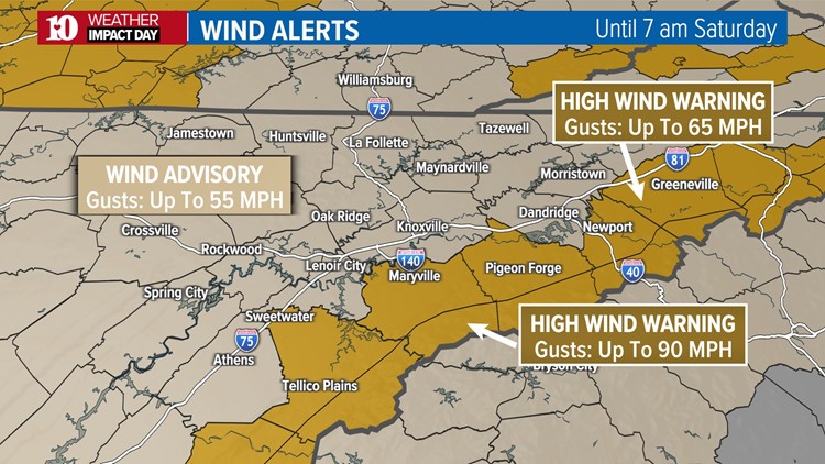
A High Wind Warning has been issued for the higher elevations of the Mountains for the potential of wind gusts up to 90 mph.
A High Wind Warning has been issued for the lower elevations of our eastern counties for gusts up to 65 mph.
A Wind Advisory has been issued for the Plateau and valley with the potential for wind gusts up to 55 mph.


The strongest wind gusts are expected to occur between noon and 6 pm as showers and a few storms move through the area.
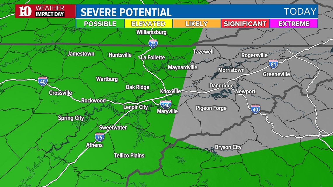
The Storm Prediction Center is highlighting most of our area under a "marginal" (level 1 of 5) risk for severe storms Friday afternoon.
This is for the potential of damaging wind gusts of 60 mph or higher and even if we don't hear thunder, those strong winds could still be brought down to the ground by heavy rain.

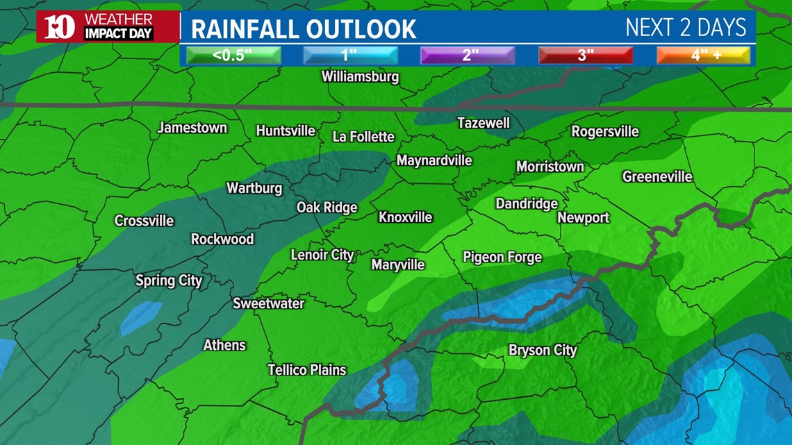
Today's rain will exit quickly during the early evening, which should help to keep rainfall totals much lower than the previous system on Tuesday.
The ground is already saturated from the heavy rain on Tuesday so there is a higher-than-normal chance for downed trees and power outages from this event.
As of now, it looks like most areas will receive around half-an-inch or less of rain, which should help to keep the flood risk to a minimum.

Once the rain moves out, colder air will come rushing in overnight Friday night into Saturday morning and any lingering showers will change from rain to snow.
As of now, it doesn't look like there will be much moisture to work with by that point so other than in the mountains, we aren't expecting more than flurries for the rest of East Tennessee.
MUCH colder air will be moving into the region behind this system and once it arrives, it looks like it could stay in place for most of next week.
Check back for updates!